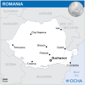
Αρχείο:Romania - Location Map (2013) - ROU - UNOCHA.svg

Τα περιεχόμενα της σελίδας δεν υποστηρίζονται σε άλλες γλώσσες.
Αυτό το αρχείο προέρχεται από το Wikimedia Commons
Από τη Βικιπαίδεια, την ελεύθερη εγκυκλοπαίδεια

Εικόνα σε υψηλότερη ανάλυση(Αρχείο SVG, ονομαστικό μέγεθος 250 × 250 εικονοστοιχεία, μέγεθος αρχείου: 941 KB)

Απόδοση της εικόνας στα .

Σύνοψη

Περιγραφή
English: Locator map of Romania.
Ημερομηνία
Πηγή
Δημιουργός
SVG ανάπτυξη
InfoField
 
Ο πηγαίος κώδικας αυτού του SVG είναι έγκυρος.
 
map δημιουργήθηκε με Inkscape.
 
 This map uses embedded text that can be easily translated using a text editor.

Αδειοδότηση

w:el:Creative Commons
αναφορά προέλευσης
Το αρχείο διανέμεται υπό την άδεια Creative Commons Αναφορά προέλευσης 3.0 Μη εισαγόμενη
Απόδοση: OCHA
Είστε ελεύθερος:
  • να μοιραστείτε – να αντιγράψετε, διανέμετε και να μεταδώσετε το έργο
  • να διασκευάσετε – να τροποποιήσετε το έργο
Υπό τις ακόλουθες προϋποθέσεις:
  • αναφορά προέλευσης – Θα πρέπει να κάνετε κατάλληλη αναφορά, να παρέχετε σύνδεσμο για την άδεια και να επισημάνετε εάν έγιναν αλλαγές. Μπορείτε να το κάνετε με οποιοδήποτε αιτιολογήσιμο λόγο, χωρίς όμως να εννοείται με οποιονδήποτε τρόπο ότι εγκρίνουν εσάς ή τη χρήση του έργου από εσάς.
This map is part of a collection of 216 free country maps, created by the UN Office for the Coordination of Humanitarian Affairs (OCHA), to be used in print, web or broadcast products.

The ReliefWeb Location Maps released here are maps that highlight a country, its capital, major populated places and the surrounding regions.

Attribution Requirements

Using the map without modifications: ensure that the sources and the disclaimer are below the map. Credit as follows: "Credit: OCHA".

For use with alteration: remove the OCHA logo and disclaimer following any modification to the map, but keep the data sources as mentioned below the map. Credit the modified map as follows: "Based on OCHA map". You are responsible for the content of your map.

We are keen to receive your feedback and hear how you used OCHA's maps. We would be grateful if you would notify us by e-mail and share your work with us.

UN Disclaimer
The designations employed and the presentation of material of this map do not imply the expression of any opinion whatsoever on the part of the Secretariat of the United Nations concerning the legal status of any country, territory, city or area or of its authorities or concerning the delimitation of its frontiers or boundaries.
VRT Wikimedia

This work is free and may be used by anyone for any purpose. If you wish to use this content, you do not need to request permission as long as you follow any licensing requirements mentioned on this page.

The Wikimedia Foundation has received an e-mail confirming that the copyright holder has approved publication under the terms mentioned on this page. This correspondence has been reviewed by a Volunteer Response Team (VRT) member and stored in our permission archive. The correspondence is available to trusted volunteers as ticket #2014031410007248.

If you have questions about the archived correspondence, please use the VRT noticeboard. Ticket link: https://ticket.wikimedia.org/otrs/index.pl?Action=AgentTicketZoom&TicketNumber=2014031410007248
Find other files from the same ticket: SDC query (SPARQL)

Λεζάντες

Δεν ορίστηκε λεζάντα

Items portrayed in this file

απεικονίζει

Ιστορικό αρχείου

Κλικάρετε σε μια ημερομηνία/ώρα για να δείτε το αρχείο όπως εμφανιζόταν εκείνη τη στιγμή.

Ώρα/Ημερομ.ΜικρογραφίαΔιαστάσειςΧρήστηςΣχόλια
τελευταία13:45, 7 Μαΐου 2022Μικρογραφία για την έκδοση της 13:45, 7 Μαΐου 2022250 × 250 (941 KB)NyilvosktFile uploaded using svgtranslate tool (https://svgtranslate.toolforge.org/). Added translation for id.
05:51, 11 Σεπτεμβρίου 2016Μικρογραφία για την έκδοση της 05:51, 11 Σεπτεμβρίου 2016250 × 250 (936 KB)Wereldburger758Correction error. Again: Resized page to drawing. Removal watermark. Validation of image.
09:57, 21 Αυγούστου 2016Μικρογραφία για την έκδοση της 09:57, 21 Αυγούστου 2016254 × 254 (919 KB)Wereldburger758Resized page to drawing. Removed watermark. Validated drawing.
01:03, 8 Μαΐου 2014Μικρογραφία για την έκδοση της 01:03, 8 Μαΐου 2014254 × 254 (916 KB)UN OCHA maps bot== {{int:filedesc}} == {{Information |description={{en|1=Locator map of Romania.}} |date=2013 |source={{en|1=[http://reliefweb.int/map/romania/romania-location-map-2013 Romania Locator Map (ReliefWeb)]}} |author={{en|1=[[w:en:United Na...

Δεν υπάρχουν σελίδες που συνδέουν σε αυτό το αρχείο.

Καθολική χρήση αρχείου

Τα ακόλουθα άλλα wiki χρησιμοποιούν αυτό το αρχείο:

Μεταδεδομένα