Πρότυπο:Location map USA
| όνομα | USA | ||
|---|---|---|---|
| x | 50.0 + 124.03149777329222*((1.9694462586094064-({{{2}}}*pi / 180))*sin(0.6010514667026994*({{{3}}} + 96)*pi / 180)) | ||
| y | 50.0 + 1.6155950752393982*124.03149777329222*( 0.02613325650382181 - (1.3236744353715044 - (1.9694462586094064 - ({{{2}}}*pi / 180))*cos(0.6010514667026994*({{{3}}} + 96)*pi / 180))) | ||
| εικόνα | Usa edcp location map.svg
| ||

| |||
| εικόνα1 | Usa edcp relief location map.png
| ||

| |||
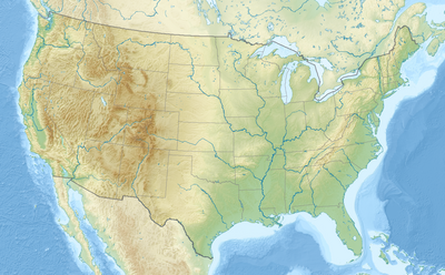
Το Πρότυπο:Location map USA είναι ένας ορισμός χάρτη τοποθεσίας που χρησιμοποιείται για να επικαλύπτονται σημάνσεις και ετικέτες σε έναν χάρτη equidistant conic projection map of the United States. Οι σημάνσεις τοποθετούνται από συντεταγμένες latitude and longitude coordinates on the default map or a similar map image.
Χρήση
[επεξεργασία κώδικα]These definitions are used by the following templates when invoked with parameter "USA":
{{Location map | USA | ...}}{{Location map many | USA | ...}}{{Location map+ | USA | ...}}{{Location map~ | USA | ...}}
Map definition
[επεξεργασία κώδικα]name =- Name used in the default map caption
image = [[:File:|]]- The default map image, without "Image:" or "File:"
εικόνα1 = [[:File:|]]- An alternative map image, usually a relief map, can be displayed via the ανάγλυφο or ΕναλλακτικόςΧάρτης parameters
x = 50.0 + 124.03149777329222*((1.9694462586094064-({{{2}}}*pi / 180))*sin(0.6010514667026994*({{{3}}} + 96)*pi / 180))- An expression to calculate a location on the map via its longitude; evaluates as 0 along the left edge and 100 along the right edge
y = 50.0 + 1.6155950752393982*124.03149777329222*( 0.02613325650382181 - (1.3236744353715044 - (1.9694462586094064 - ({{{2}}}*pi / 180))*cos(0.6010514667026994*({{{3}}} + 96)*pi / 180)))- An expression to calculate a location on the map via its latitude; evaluates as 0 along the top edge and 100 along the bottom edge
Εναλλακτικός χάρτης
[επεξεργασία κώδικα]The map defined as image1 () can be displayed by using the relief or AlternativeMap parameters in {{Location map}}, {{Location map many}} and {{Location map+}}. The use of these two parameters is shown in the examples below. Additional examples can be found at:
- Πρότυπο:Location map#Relief parameter
- Πρότυπο:Location map#AlternativeMap parameter
- Πρότυπο:Location map+/relief
- Πρότυπο:Location map+/AlternativeMap
Examples using location map templates
[επεξεργασία κώδικα]Location map, using default map (image)
[επεξεργασία κώδικα]{{Location map | USA
| width = 250
| label = Washington, D.C.
| lat_deg = 38.89
| long_deg = -77.04
}}
Location map many, using relief map (image1)
[επεξεργασία κώδικα]Lua error in Module:Location_map at line 430: No value was provided for longitude.
{{Location map many | USA
| relief = yes
| width   = 250
| caption  = Two locations in the USA
| label1 = Washington, D.C.
| lat1_deg = 38.89
| long1_deg = -77.04
| label2   = Seattle
| lat2_deg = 47.61
| long2_deg = -122.33
}}
Location map+, using AlternativeMap
[επεξεργασία κώδικα]{{Location map+ | USA
| AlternativeMap = Usa edcp relief location map.png
| caption = Two locations in the USA
| width = 250
| places =
{{Location map~ | USA
| label = Washington, D.C.
| lat_deg = 38.89
| long_deg = -77.04
}}
{{Location map~ | USA
| label = Seattle
| lat_deg = 47.61
| long_deg = -122.33
}}
}}
Βλέπε επίσης
[επεξεργασία κώδικα]- Location map templates
- Πρότυπο:Location map, to display one mark and label using latitude and longitude
- Πρότυπο:Location map many, to display up to nine marks and labels
- Πρότυπο:Location map+, to display an unlimited number of marks and labels
- Infobox templates incorporating (passing values to) the Location map template
| Η παραπάνω τεκμηρίωση ενσωματώνεται από τη σελίδα Πρότυπο:Location map USA/τεκμηρίωση. (επεξεργασία | ιστορικό) Οι συντάκτες μπορούν να πειραματίζονται στο αμμοδοχείο (δημιουργία | αντίγραφο) και στις δοκιμαστικές σελίδες (δημιουργία) του προτύπου. Παρακαλούμε να προσθέτετε τις κατηγορίες στην υποσελίδα τεκμηρίωσης. Υποσελίδες αυτής της σελίδας. |


