
Αρχείο:Map of Indiana highlighting Union County.svg

Το μέγεθος αυτής της PNG προεπισκόπησης αυτού του SVG το αρχείο: 391 × 599 εικονοστοιχεία. Άλλες αναλύσεις: 156 × 240 εικονοστοιχεία | 313 × 480 εικονοστοιχεία | 501 × 768 εικονοστοιχεία | 668 × 1.024 εικονοστοιχεία | 1.337 × 2.048 εικονοστοιχεία | 722 × 1.106 εικονοστοιχεία.
Εικόνα σε υψηλότερη ανάλυση (Αρχείο SVG, ονομαστικό μέγεθος 722 × 1.106 εικονοστοιχεία, μέγεθος αρχείου: 42 KB)
|
|
Αυτό το αρχείο και η περιγραφή του προέρχονται από το Wikimedia Commons. Οι πληροφορίες από την σελίδα περιγραφής του εκεί εμφανίζονται παρακάτω. |
Σύνοψη
| Περιγραφή |
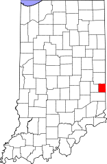
English: This is a locator map showing Union County in Indiana. For more information, see Commons:United States county locator maps. |
| Ημερομηνία | |
| Πηγή |
Έργο αυτού που το ανεβάζει: English: The maps use data from nationalatlas.gov, specifically countyp020.tar.gz on the Raw Data Download page. The maps also use state outline data from statesp020.tar.gz. The Florida maps use hydrogm020.tar.gz to display Lake Okeechobee. |
| Δημιουργός | David Benbennick |
Αδειοδότηση
| Εγώ, ο κάτοχος των πνευματικών δικαιωμάτων αυτού του έργου, δημοσιεύω αυτό το έργο ως κοινό κτήμα. Αυτό ισχύει σε παγκόσμια κλίμακα. Σε ορισμένες χώρες αυτό μπορεί να μην είναι νομικά εφικτό. Αν ναι: Παραχωρώ σε οποιονδήποτε το δικαίωμα να χρησιμοποιήσει αυτό το έργο "για οποιονδήποτε σκοπό", χωρίς κανέναν όρο, εκτός και αν τέτοιοι όροι τίθενται από την νομοθεσία |
Ιστορικό αρχείου
Κλικάρετε σε μια ημερομηνία/ώρα για να δείτε το αρχείο όπως εμφανιζόταν εκείνη τη στιγμή.
| Ώρα/Ημερομ. | Μικρογραφία | Διαστάσεις | Χρήστης | Σχόλια | |
|---|---|---|---|---|---|
| τελευταία | 14:50, 25 Ιουνίου 2024 | | 722 × 1.106 (42 KB) | Nux | uniform colors with good contrast |
| 20:42, 19 Ιουνίου 2024 |  | 722 × 1.106 (42 KB) | Nux | fix rendering (remove clipping) | |
| 12:12, 12 Φεβρουαρίου 2006 |  | 2.887 × 4.423 (56 KB) | David Benbennick | {{subst:User:Dbenbenn/clm|county=Union County|state=Indiana}} |
Συνδέσεις αρχείου
Τα παρακάτω λήμματα συνδέουν σε αυτό το αρχείο:
Καθολική χρήση αρχείου
Τα ακόλουθα άλλα wiki χρησιμοποιούν αυτό το αρχείο:
- Χρήση σε ar.wikipedia.org
- Χρήση σε bg.wikipedia.org
- Χρήση σε bpy.wikipedia.org
- Χρήση σε cdo.wikipedia.org
- Χρήση σε ceb.wikipedia.org
- Χρήση σε ce.wikipedia.org
- Χρήση σε cy.wikipedia.org
- Χρήση σε de.wikipedia.org
- Χρήση σε en.wikipedia.org
- List of counties in Indiana
- Union County, Indiana
- Liberty, Indiana
- West College Corner, Indiana
- Template:Union County, Indiana
- Brownsville Township, Union County, Indiana
- Center Township, Union County, Indiana
- Harmony Township, Union County, Indiana
- Harrison Township, Union County, Indiana
- Liberty Township, Union County, Indiana
- Union Township, Union County, Indiana
- Brownsville, Indiana
- Dunlapsville, Indiana
- User:Nyttend/County templates/IN/2
- National Register of Historic Places listings in Union County, Indiana
- Category:Populated places in Union County, Indiana
- List of Indiana state historical markers in Union County
- Template:UnionCountyIN-geo-stub
- User:Br.gamache/sandbox
- Billingsville, Indiana
- Charlottesville, Union County, Indiana
- Clifton, Indiana
- Cottage Grove, Indiana
- Five Points, Union County, Indiana
- Lotus, Indiana
- Philomath, Indiana
- Roseburg, Union County, Indiana
- Salem, Union County, Indiana
- Witts Station, Indiana
- Yankee Town, Indiana
- Goodwins Corner, Indiana
- Kitchel, Indiana
- Quakertown, Indiana
- Hopeville, Indiana
- Χρήση σε eo.wikipedia.org
- Χρήση σε es.wikipedia.org
- Χρήση σε et.wikipedia.org
- Χρήση σε eu.wikipedia.org
- Χρήση σε fa.wikipedia.org
Δείτε περισσότερη καθολική χρήση αυτού του αρχείου.