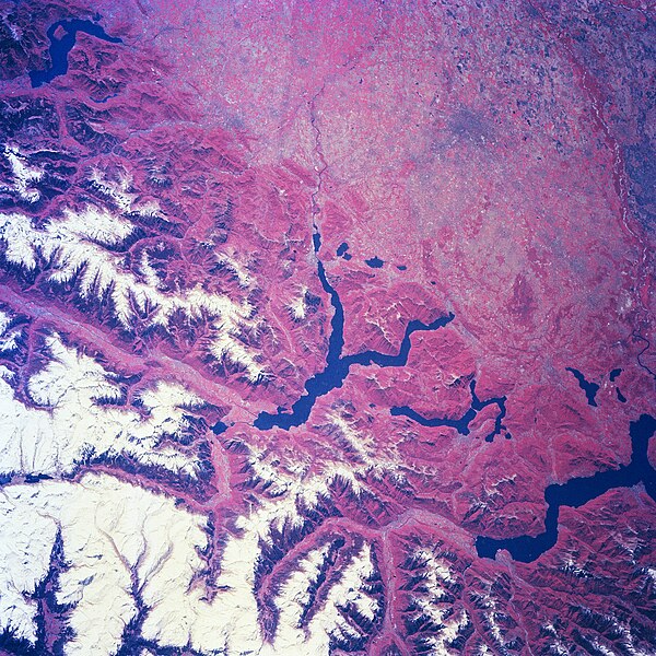
Αρχείο:Lombardy.satellite.jpg
Εμφάνιση

Μέγεθος αυτής της προεπισκόπησης: 600 × 600 εικονοστοιχεία . Άλλες αναλύσεις: 240 × 240 εικονοστοιχεία | 480 × 480 εικονοστοιχεία | 768 × 768 εικονοστοιχεία | 1.024 × 1.024 εικονοστοιχεία | 2.048 × 2.048 εικονοστοιχεία | 4.055 × 4.055 εικονοστοιχεία.
Εικόνα σε υψηλότερη ανάλυση (4.055 × 4.055 εικονοστοιχεία, μέγεθος αρχείου: 15,2 MB, τύπος MIME: image/jpeg)
Ιστορικό αρχείου
Κλικάρετε σε μια ημερομηνία/ώρα για να δείτε το αρχείο όπως εμφανιζόταν εκείνη τη στιγμή.
| Ώρα/Ημερομ. | Μικρογραφία | Διαστάσεις | Χρήστης | Σχόλια | |
|---|---|---|---|---|---|
| τελευταία | 21:18, 24 Ιουλίου 2023 |  | 4.055 × 4.055 (15,2 MB) | Don-vip | |
| 19:05, 5 Αυγούστου 2006 |  | 639 × 639 (391 KB) | Lange~commonswiki | {{Information |Description= Several elongated lakes (dark features) are identifiable in this southerly view of the Italian-Swiss border. The elongated lakes are the creation of alpine (or valley) glaciers that moved generally southward through this sectio |
Συνδέσεις αρχείου
Τα παρακάτω λήμματα συνδέουν σε αυτό το αρχείο:
Καθολική χρήση αρχείου
Τα ακόλουθα άλλα wiki χρησιμοποιούν αυτό το αρχείο:
- Χρήση σε ar.wikipedia.org
- Χρήση σε arz.wikipedia.org
- Χρήση σε ast.wikipedia.org
- Χρήση σε az.wikipedia.org
- Χρήση σε be.wikipedia.org
- Χρήση σε bg.wikipedia.org
- Χρήση σε ca.wikipedia.org
- Χρήση σε cy.wikipedia.org
- Χρήση σε de.wikivoyage.org
- Χρήση σε diq.wikipedia.org
- Χρήση σε fi.wikipedia.org
- Χρήση σε fr.wikipedia.org
- Χρήση σε fr.wikivoyage.org
- Χρήση σε ga.wikipedia.org
- Χρήση σε gd.wikipedia.org
- Χρήση σε gl.wikipedia.org
- Χρήση σε he.wikipedia.org
- Χρήση σε hy.wikipedia.org
- Χρήση σε ia.wikipedia.org
- Χρήση σε id.wikipedia.org
- Χρήση σε ilo.wikipedia.org
- Χρήση σε it.wikipedia.org
- Χρήση σε ka.wikipedia.org
- Χρήση σε ku.wikipedia.org
- Χρήση σε la.wikipedia.org
- Χρήση σε mzn.wikipedia.org
- Χρήση σε nn.wikipedia.org
- Χρήση σε no.wikipedia.org
- Χρήση σε oc.wikipedia.org
- Χρήση σε pl.wikipedia.org
- Χρήση σε ro.wikipedia.org
- Χρήση σε ru.wikipedia.org
- Χρήση σε ru.wikinews.org
- Χρήση σε sl.wikipedia.org
- Χρήση σε sr.wikipedia.org
- Χρήση σε tt.wikipedia.org
- Χρήση σε vec.wikipedia.org
- Χρήση σε vi.wikipedia.org
- Χρήση σε www.wikidata.org


