
Αρχείο:WielkoPolska epoki Piastowskiej.jpg

Εικόνα σε υψηλότερη ανάλυση (4.075 × 3.613 εικονοστοιχεία, μέγεθος αρχείου: 10,46 MB, τύπος MIME: image/jpeg)
|
|
Αυτό το αρχείο και η περιγραφή του προέρχονται από το Wikimedia Commons. Οι πληροφορίες από την σελίδα περιγραφής του εκεί εμφανίζονται παρακάτω. |
Σύνοψη
| Περιγραφή |
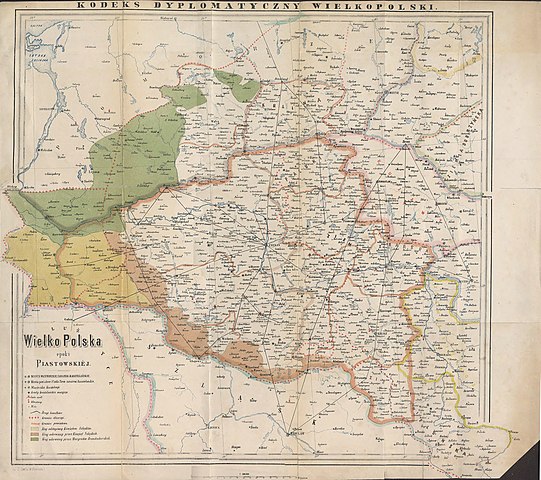
English: Historical map of Greater Poland (Middle Ages) made by Dr. T. Szulc and included in the 4th volume of Codex diplomaticus Maioris Poloniae
Polski: Historyczna mapa Wielkopolski w epoce piastowskiej wykonana przez Dr. T. Szulca i zamieszczona w 4. tomie Kodeksu dyplomatycznego Wielkopolski |
| Ημερομηνία | |
| Πηγή | Kodeks dyplomatyczny Wielkopolski obejmujący dokumenta tak już drukowane, jak dotąd nie ogłoszone, sięgające do roku 1400, t.4, Poznań 1881 - Mapa Wielkopolski |
| Δημιουργός | Dr. T. Szulc |
| άλλες εκδόσεις | Derivative works of this file: Land given up to Silesian dukes (Dr. T. Szulc).jpg |
.jpg)
Αδειοδότηση
|
Αυτό το έργο είναι κοινό κτήμα στη χώρα προέλευσής του και άλλες χώρες και περιοχές όπου η διάρκεια πνευματικών δικαιωμάτων είναι όσο η ζωή του δημιουργού και μέχρι 70 χρόνια μετά ή λιγότερο.
| |
| Αυτό το αρχείο έχει χαρακτηριστεί ως απαλλαγμένο από γνωστούς περιορισμούς βάσει της νομοθεσίας περί πνευματικής ιδιοκτησίας, περιλαμβανομένων όλων των συναφών και συγγενικών δικαιωμάτων. | |
Ιστορικό αρχείου
Κλικάρετε σε μια ημερομηνία/ώρα για να δείτε το αρχείο όπως εμφανιζόταν εκείνη τη στιγμή.
| Ώρα/Ημερομ. | Μικρογραφία | Διαστάσεις | Χρήστης | Σχόλια | |
|---|---|---|---|---|---|
| τελευταία | 15:28, 22 Ιουνίου 2009 | | 4.075 × 3.613 (10,46 MB) | Paelius | {{Information |Description={{en|1=Historical map of Greater Poland (Middle Ages) made by Dr. T. Szulc and included in the 4th volume of Codex diplomaticus Maioris Poloniae}} {{pl|1=Historyczna mapa Wielkopolski w epoce piastowskiej wykonana przez Dr. T. S |
Συνδέσεις αρχείου
Τα παρακάτω λήμματα συνδέουν σε αυτό το αρχείο:
Καθολική χρήση αρχείου
Τα ακόλουθα άλλα wiki χρησιμοποιούν αυτό το αρχείο:
- Χρήση σε azb.wikipedia.org
- Χρήση σε bg.wikipedia.org
- Χρήση σε ca.wikipedia.org
- Χρήση σε cs.wikipedia.org
- Χρήση σε da.wikipedia.org
- Χρήση σε de.wikipedia.org
- Χρήση σε dsb.wikipedia.org
- Χρήση σε en.wikipedia.org
- Χρήση σε es.wikipedia.org
- Χρήση σε et.wikipedia.org
- Χρήση σε fa.wikipedia.org
- Χρήση σε hr.wikipedia.org
- Χρήση σε mk.wikipedia.org
- Χρήση σε nl.wikipedia.org
- Χρήση σε no.wikipedia.org
- Χρήση σε pl.wikipedia.org
- Piła (miasto)
- Głogów
- Wielkopolska
- Jarocin
- Sieraków
- Władysław Odonic
- Bolesław Pobożny
- Lubusz
- Chwarszczany
- Nowa Marchia
- Międzyrzecz
- Świebodzin
- Wschowa
- Łagów (powiat świebodziński)
- Powiat wałecki
- Powiat górowski
- Powiat milicki
- Powiat międzyrzecki
- Międzychód
- Odolanów
- Opole (średniowiecze)
- Osieczna
- Buk (miasto)
- Zamek w Międzyrzeczu
- Kościan
Δείτε περισσότερη καθολική χρήση αυτού του αρχείου.