
Αρχείο:Taman map.png
Δεν διατίθεται υψηλότερη ανάλυση.
Taman_map.png (452 × 330 εικονοστοιχεία, μέγεθος αρχείου: 33 KB, τύπος MIME: image/png)
|
|
Αυτό το αρχείο και η περιγραφή του προέρχονται από το Wikimedia Commons. Οι πληροφορίες από την σελίδα περιγραφής του εκεί εμφανίζονται παρακάτω. |
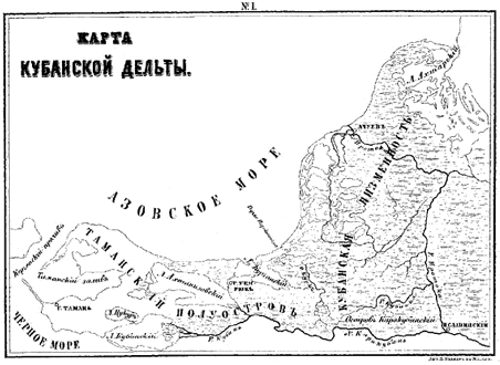
Σύνοψη
| Περιγραφή | A map of the Taman peninsula. |
| Πηγή | From Gerz, K. Arkheologicheskaya topografiya Tamanskogo poluostrova. Moscow: The Moscow Archaeological Society, 1870. |
| Δημιουργός |
Αδειοδότηση
This file is a Ukrainian or Ukrainian SSR work and it is presently in the public domain in Ukraine, because it was published before January 1, 1954, and the creator (if known) died before that date (details).
|
 |
Αυτό το έργο είναι κοινό κτήμα στις Ηνωμένες Πολιτείες επειδή δημοσιεύτηκε (ή καταχωρήθηκε στο U.S. Copyright Office) πριν την 1 Ιανουαρίου 1929.
Έργα που είναι κοινό κτήμα πρέπει να μην υπόκεινται σε πνευματικά δικαιώματα και στις Ηνωμένες Πολιτείες και στην χώρα προέλευσης του έργου για να φιλοξενηθούν στα Commons. Αν το έργο δεν είναι έργο από τις ΗΠΑ, το αρχείο πρέπει να έχει μια πρόσθετη ετικέτα πνευματικών δικαιωμάτων που να δείχνει το καθεστώς πνευματικών δικαιωμάτων του στην χώρα προέλευσης.
|
Ιστορικό αρχείου
Κλικάρετε σε μια ημερομηνία/ώρα για να δείτε το αρχείο όπως εμφανιζόταν εκείνη τη στιγμή.
| Ώρα/Ημερομ. | Μικρογραφία | Διαστάσεις | Χρήστης | Σχόλια | |
|---|---|---|---|---|---|
| τελευταία | 06:44, 19 Απριλίου 2007 | | 452 × 330 (33 KB) | Joonasl | {{Information |Description=A map of the Taman peninsula. |Source=From Gerz, K. ''Arkheologicheskaya topografiya Tamanskogo poluostrova.'' Moscow: The Moscow Archaeological Society, 1870. |Date= |Author= |Permission= |other_versions= }} {{PD-Russia}} [[C |
Συνδέσεις αρχείου
Τα παρακάτω λήμματα συνδέουν σε αυτό το αρχείο:
Καθολική χρήση αρχείου
Τα ακόλουθα άλλα wiki χρησιμοποιούν αυτό το αρχείο:
- Χρήση σε az.wikipedia.org
- Χρήση σε bg.wikipedia.org
- Χρήση σε en.wikipedia.org
- Χρήση σε eo.wikipedia.org
- Χρήση σε es.wikipedia.org
- Χρήση σε fi.wikipedia.org
- Χρήση σε fr.wikipedia.org
- Χρήση σε hi.wikipedia.org
- Χρήση σε hr.wikipedia.org
- Χρήση σε hy.wikipedia.org
- Χρήση σε id.wikipedia.org
- Χρήση σε it.wikipedia.org
- Χρήση σε ja.wikipedia.org
- Χρήση σε ka.wikipedia.org
- Χρήση σε la.wikipedia.org
- Χρήση σε ml.wikipedia.org
- Χρήση σε mt.wikipedia.org
- Χρήση σε nn.wikipedia.org
- Χρήση σε pt.wikipedia.org
- Χρήση σε ru.wikipedia.org
- Χρήση σε sh.wikipedia.org
- Χρήση σε sl.wikipedia.org
- Χρήση σε sr.wikipedia.org
- Χρήση σε sv.wikipedia.org
- Χρήση σε tr.wikipedia.org
- Χρήση σε uk.wikipedia.org