
Αρχείο:South-eastern Europe 1340.jpg
Μέγεθος αυτής της προεπισκόπησης: 773 × 599 εικονοστοιχεία . Άλλες αναλύσεις: 310 × 240 εικονοστοιχεία | 619 × 480 εικονοστοιχεία | 991 × 768 εικονοστοιχεία | 1.122 × 870 εικονοστοιχεία.
Εικόνα σε υψηλότερη ανάλυση (1.122 × 870 εικονοστοιχεία, μέγεθος αρχείου: 330 KB, τύπος MIME: image/jpeg)
|
|
Αυτό το αρχείο και η περιγραφή του προέρχονται από το Wikimedia Commons. Οι πληροφορίες από την σελίδα περιγραφής του εκεί εμφανίζονται παρακάτω. |
Σύνοψη
| Περιγραφή |
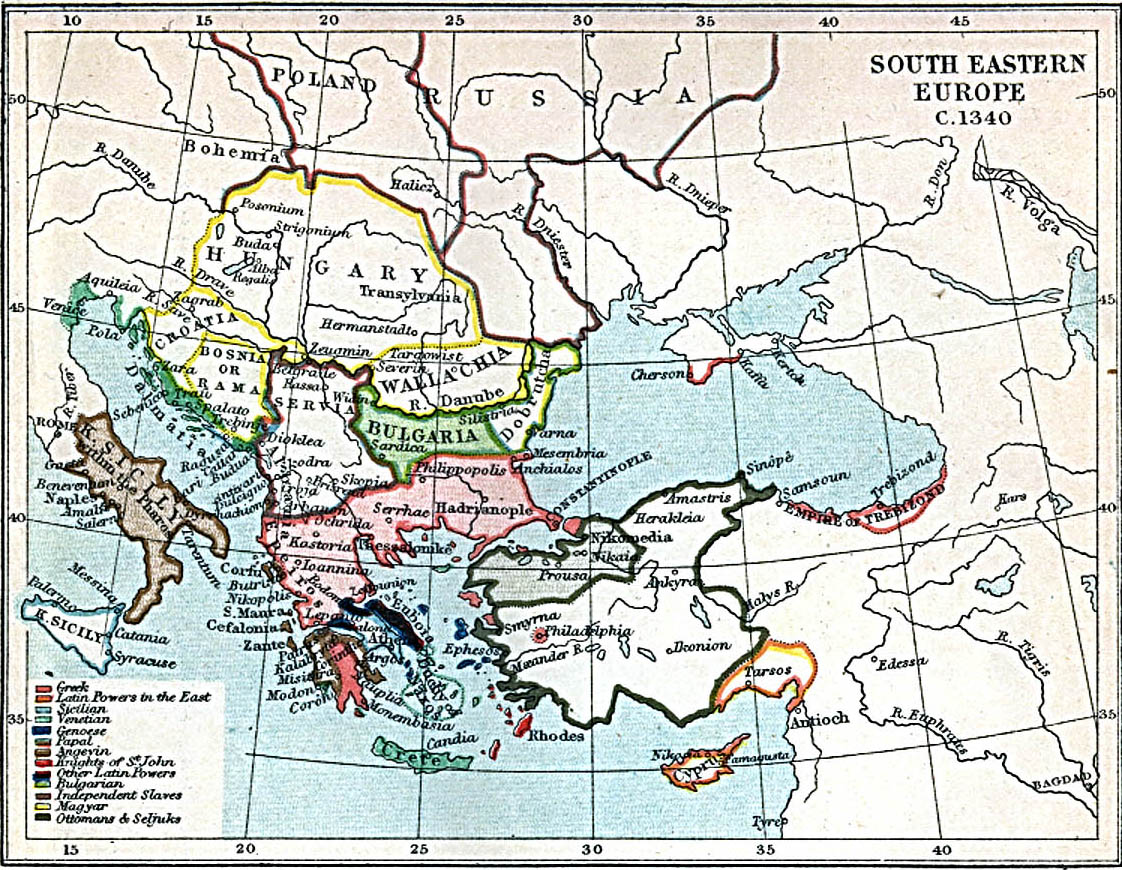
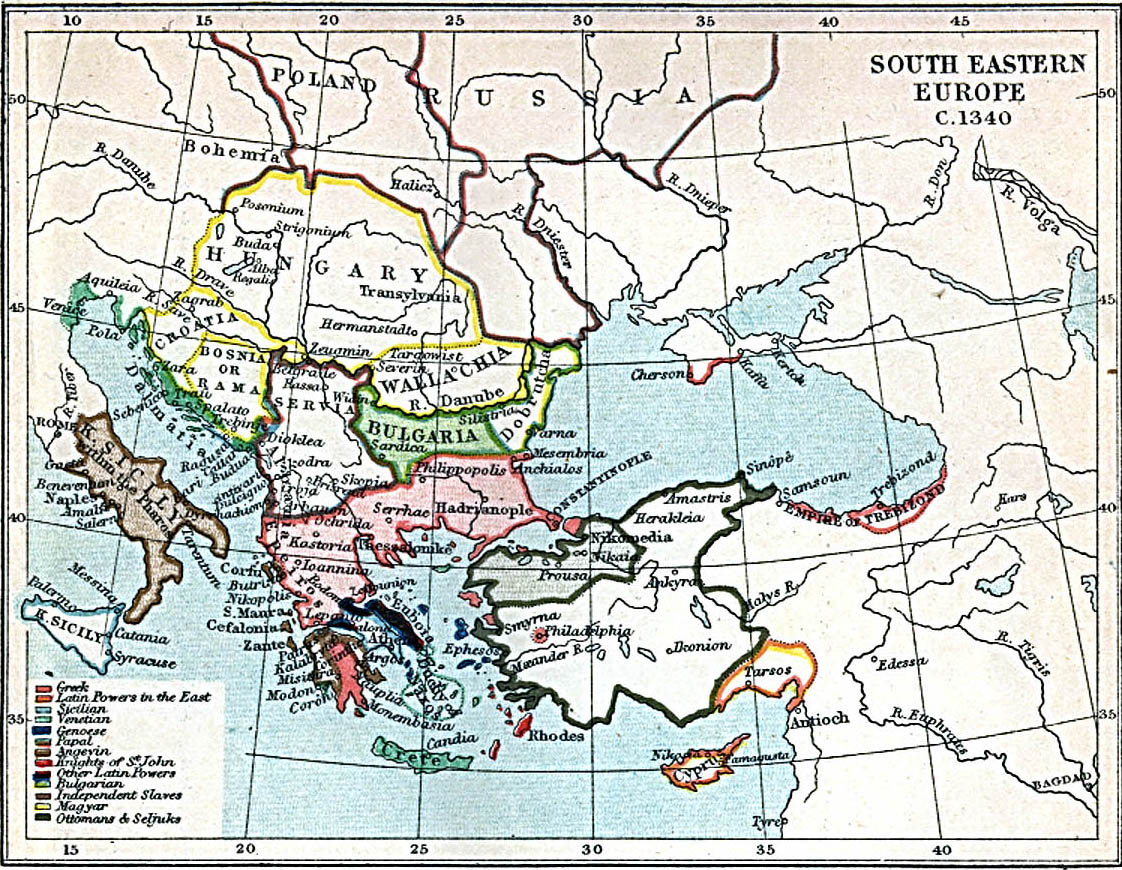
English: Map of south-eastern Europe ca. 1340 AD. |
| Ημερομηνία | |
| Πηγή | Map at the Perry-Castañeda Library Map Collection of the University of Texas |
| Δημιουργός | J.B. Bury |
Αδειοδότηση
This media file is in the public domain in the United States. This applies to U.S. works where the copyright has expired, often because its first publication occurred prior to January 1, 1929, and if not then due to lack of notice or renewal. See this page for further explanation.
|
 | |
 |
This image might not be in the public domain outside of the United States; this especially applies in the countries and areas that do not apply the rule of the shorter term for US works, such as Canada, Mainland China (not Hong Kong or Macao), Germany, Mexico, and Switzerland. The creator and year of publication are essential information and must be provided. See Wikipedia:Public domain and Wikipedia:Copyrights for more details.
|
Ιστορικό αρχείου
Κλικάρετε σε μια ημερομηνία/ώρα για να δείτε το αρχείο όπως εμφανιζόταν εκείνη τη στιγμή.
| Ώρα/Ημερομ. | Μικρογραφία | Διαστάσεις | Χρήστης | Σχόλια | |
|---|---|---|---|---|---|
| τελευταία | 12:27, 29 Μαρτίου 2010 | | 1.122 × 870 (330 KB) | Cplakidas | {{Information |Description={{en|1=Map of south-eastern Europe ca. 1340 AD.}} |Source=[http://www.lib.utexas.edu/maps/historical/se_europe_1340.jpg Map] at the [http://www.lib.utexas.edu/maps/ Perry-Castañeda Library Map Collection] of the University of T |
Συνδέσεις αρχείου
Τα παρακάτω λήμματα συνδέουν σε αυτό το αρχείο:
Καθολική χρήση αρχείου
Τα ακόλουθα άλλα wiki χρησιμοποιούν αυτό το αρχείο:
- Χρήση σε en.wikipedia.org
- Χρήση σε es.wikipedia.org
- Χρήση σε fa.wikipedia.org
- Χρήση σε it.wikipedia.org
- Χρήση σε ja.wikipedia.org
- Χρήση σε pt.wikipedia.org
- Χρήση σε ru.wikipedia.org
- Χρήση σε sh.wikipedia.org
- Χρήση σε uk.wikipedia.org
- Χρήση σε zh.wikipedia.org