
Αρχείο:Sattelite Wiesbaden Mainz.jpg

Μέγεθος αυτής της προεπισκόπησης: 800 × 599 εικονοστοιχεία . Άλλες αναλύσεις: 320 × 240 εικονοστοιχεία | 640 × 479 εικονοστοιχεία | 1.024 × 766 εικονοστοιχεία | 1.280 × 958 εικονοστοιχεία.
Εικόνα σε υψηλότερη ανάλυση (1.280 × 958 εικονοστοιχεία, μέγεθος αρχείου: 164 KB, τύπος MIME: image/jpeg)
|
|
Αυτό το αρχείο και η περιγραφή του προέρχονται από το Wikimedia Commons. Οι πληροφορίες από την σελίδα περιγραφής του εκεί εμφανίζονται παρακάτω. |
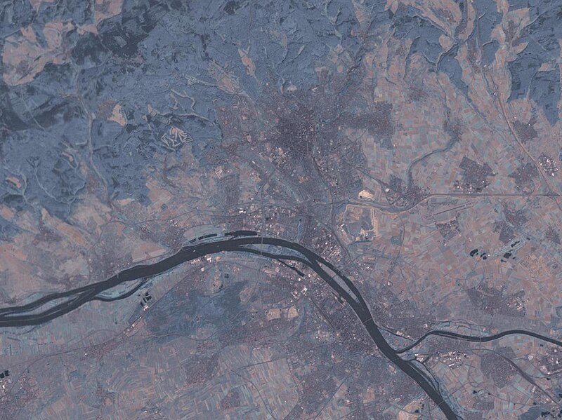
English: Satellite image of the cities Wiesbaden (north) and Mainz (south), and the confluence of the rivers Main and Rhine.
- Source: NASA World Wind - Used Filter: "Community: Landsat 7 (Visible Color)"
| Object location | | View this and other nearby images on: OpenStreetMap |
|---|
- License: "The Landsat Global Mosiac, Blue Marble, and the USGS raster maps and images are all Public Domain." (See http://www.worldwindcentral.com/wiki/Unofficial_FAQ#Are_images_on_World_Wind_copyrighted.3F ) - PD
| This image is in the public domain because it is a screenshot from NASA’s globe software World Wind using a public domain layer, such as Blue Marble, MODIS, Landsat, SRTM, USGS or GLOBE.
|
 |
Ιστορικό αρχείου
Κλικάρετε σε μια ημερομηνία/ώρα για να δείτε το αρχείο όπως εμφανιζόταν εκείνη τη στιγμή.
| Ώρα/Ημερομ. | Μικρογραφία | Διαστάσεις | Χρήστης | Σχόλια | |
|---|---|---|---|---|---|
| τελευταία | 00:19, 20 Μαρτίου 2005 | | 1.280 × 958 (164 KB) | Leipnizkeks | Sattelite image of Wiesbaden and Mainz - Source: NASA World Wind - Used Filter: "Community: Landsat 7 (Visible Color)" - License: "The Landsat Global Mosiac, Blue Marble, and the USGS raster maps and images are all Public Domain." (See http://www.worldwin |
Συνδέσεις αρχείου
Δεν υπάρχουν σελίδες που συνδέουν σε αυτό το αρχείο.
Καθολική χρήση αρχείου
Τα ακόλουθα άλλα wiki χρησιμοποιούν αυτό το αρχείο:
- Χρήση σε azb.wikipedia.org
- Χρήση σε da.wikipedia.org
- Χρήση σε en.wikipedia.org
- Χρήση σε eu.wikipedia.org
- Χρήση σε fr.wikipedia.org
- Χρήση σε hu.wikipedia.org
- Χρήση σε it.wikipedia.org
- Χρήση σε ro.wikipedia.org
- Χρήση σε tr.wikipedia.org
- Χρήση σε uk.wikipedia.org
- Χρήση σε yi.wikipedia.org
- Χρήση σε zh.wikipedia.org