
Αρχείο:Historical map of Bakhmut in Ukraine (cropped).jpg

Εικόνα σε υψηλότερη ανάλυση (8.250 × 5.799 εικονοστοιχεία, μέγεθος αρχείου: 3,26 MB, τύπος MIME: image/jpeg)
|
|
Αυτό το αρχείο και η περιγραφή του προέρχονται από το Wikimedia Commons. Οι πληροφορίες από την σελίδα περιγραφής του εκεί εμφανίζονται παρακάτω. |
Σύνοψη
| Περιγραφή |
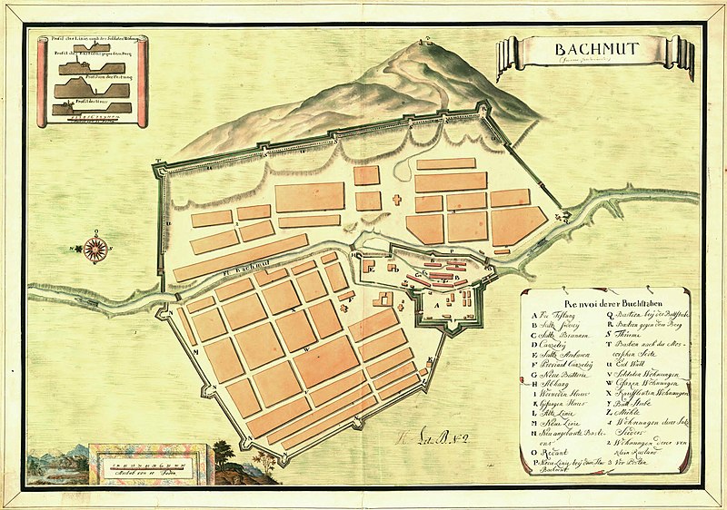
English: Historical map of Bakhmut in Ukraine, possibly 17th centrury. The map also includes cross-sections of the fortification walls. |
||||||||||||||||||||||||||
| Ημερομηνία | Possibly 17th century | ||||||||||||||||||||||||||
| Πηγή |
Utländska stads- och fästningsplaner, Bachmut, SE/KrA/0406/19/004/001, bildid: K0004367_00001 https://sok.riksarkivet.se/arkiv/0rjBXKbS5aY5ZrCxWRyyFD |
||||||||||||||||||||||||||
| Δημιουργός |
Άγνωστος |
||||||||||||||||||||||||||
| Άδεια (Επαναχρησιμοποίηση αυτού του αρχείου) |
|
||||||||||||||||||||||||||
| Georeferencing | If inappropriate please set warp_status = skip to hide. | ||||||||||||||||||||||||||
| άλλες εκδόσεις | |||||||||||||||||||||||||||


.jpg?uselang=el)
Αδειοδότηση
|
Αυτό το έργο είναι κοινό κτήμα στη χώρα προέλευσής του και άλλες χώρες και περιοχές όπου η διάρκεια πνευματικών δικαιωμάτων είναι όσο η ζωή του δημιουργού και μέχρι 70 χρόνια μετά ή λιγότερο.
| |
| Αυτό το αρχείο έχει χαρακτηριστεί ως απαλλαγμένο από γνωστούς περιορισμούς βάσει της νομοθεσίας περί πνευματικής ιδιοκτησίας, περιλαμβανομένων όλων των συναφών και συγγενικών δικαιωμάτων. | |
Ιστορικό αρχείου
Κλικάρετε σε μια ημερομηνία/ώρα για να δείτε το αρχείο όπως εμφανιζόταν εκείνη τη στιγμή.
| Ώρα/Ημερομ. | Μικρογραφία | Διαστάσεις | Χρήστης | Σχόλια | |
|---|---|---|---|---|---|
| τελευταία | 13:21, 29 Σεπτεμβρίου 2022 | | 8.250 × 5.799 (3,26 MB) | DivadH | File:Historical map of Bakhmut in Ukraine.jpg cropped 1 % horizontally, 8 % vertically using CropTool with precise mode. |
Συνδέσεις αρχείου
Τα παρακάτω λήμματα συνδέουν σε αυτό το αρχείο:
Καθολική χρήση αρχείου
Τα ακόλουθα άλλα wiki χρησιμοποιούν αυτό το αρχείο:
- Χρήση σε de.wikipedia.org
- Χρήση σε en.wikipedia.org
- Χρήση σε es.wikipedia.org
- Χρήση σε gl.wikipedia.org
- Χρήση σε it.wikipedia.org
- Χρήση σε outreach.wikimedia.org
- Χρήση σε pt.wikipedia.org
- Χρήση σε sl.wikipedia.org
- Χρήση σε sv.wikipedia.org
.jpg)