
Αρχείο:Sulphur Tornado Radar Image.png
Μέγεθος αυτής της προεπισκόπησης: 800 × 394 εικονοστοιχεία . Άλλες αναλύσεις: 320 × 158 εικονοστοιχεία | 640 × 315 εικονοστοιχεία | 1.024 × 505 εικονοστοιχεία | 1.280 × 631 εικονοστοιχεία | 2.322 × 1.144 εικονοστοιχεία.
Εικόνα σε υψηλότερη ανάλυση (2.322 × 1.144 εικονοστοιχεία, μέγεθος αρχείου: 5,03 MB, τύπος MIME: image/png)
|
|
Αυτό το αρχείο και η περιγραφή του προέρχονται από το Wikimedia Commons. Οι πληροφορίες από την σελίδα περιγραφής του εκεί εμφανίζονται παρακάτω. |
Σύνοψη
| Περιγραφή |
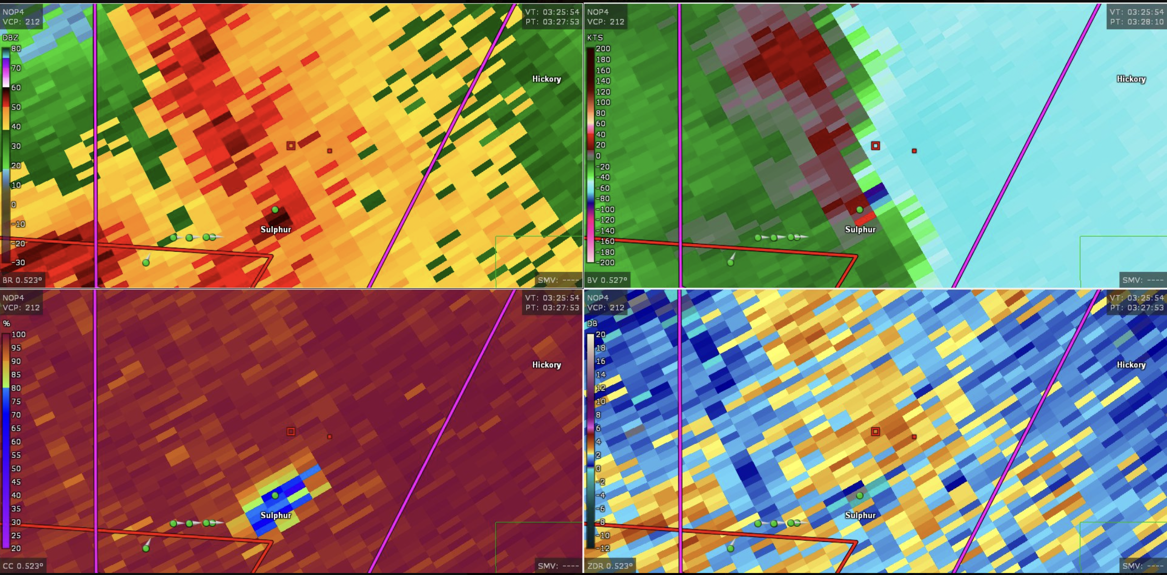
English: This image shows the radar presentation of a damaging tornado in Sulphu,r Oklahoma on April 27, 2024. |
| Ημερομηνία | |
| Πηγή | NEXRAD |
| Δημιουργός | National Weather Service, Federal Aviation Administration, United States Air Force |
Αδειοδότηση
This image is in the public domain because it is from one or more of the U.S. government’s 159 NEXRAD radars, which are jointly owned and operated by the National Weather Service (NWS), an agency of the National Oceanic and Atmospheric Administration (NOAA) within the United States Department of Commerce, the Federal Aviation Administration (FAA) within the Department of Transportation, and the U.S. Air Force within the Department of Defense.
Thus all NEXRAD images are public domain.
|
  |
Ιστορικό αρχείου
Κλικάρετε σε μια ημερομηνία/ώρα για να δείτε το αρχείο όπως εμφανιζόταν εκείνη τη στιγμή.
| Ώρα/Ημερομ. | Μικρογραφία | Διαστάσεις | Χρήστης | Σχόλια | |
|---|---|---|---|---|---|
| τελευταία | 19:44, 28 Απριλίου 2024 | | 2.322 × 1.144 (5,03 MB) | Floriangkmcc | Uploaded a work by The National Weather Service from Nexrad Radar with UploadWizard |
Συνδέσεις αρχείου
Δεν υπάρχουν σελίδες που συνδέουν σε αυτό το αρχείο.