
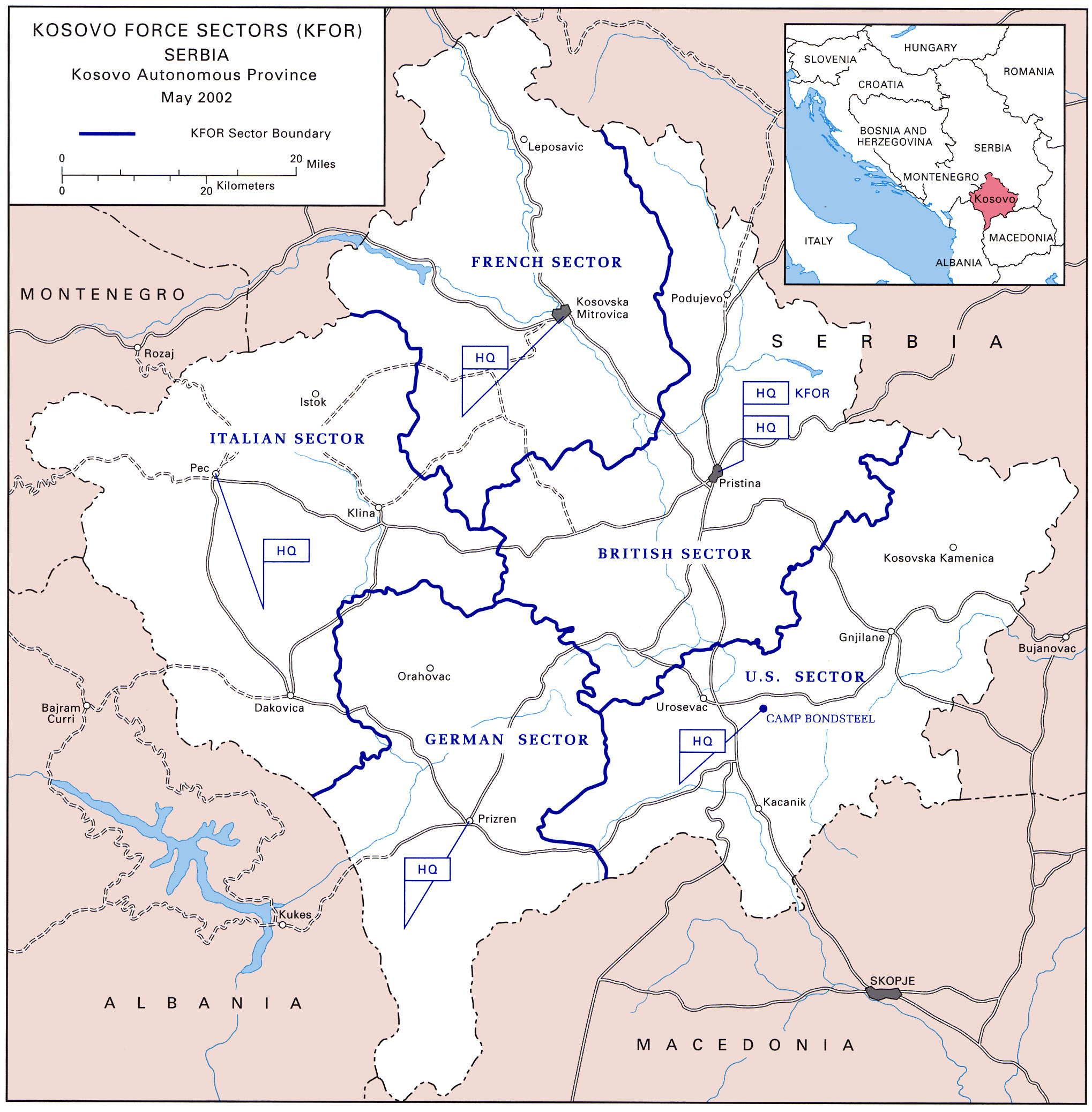
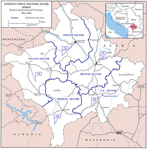
Αρχείο:KFOR Sectors 2002.jpg
Μέγεθος αυτής της προεπισκόπησης: 589 × 600 εικονοστοιχεία . Άλλες αναλύσεις: 236 × 240 εικονοστοιχεία | 471 × 480 εικονοστοιχεία | 754 × 768 εικονοστοιχεία | 1.006 × 1.024 εικονοστοιχεία | 2.038 × 2.075 εικονοστοιχεία.
Εικόνα σε υψηλότερη ανάλυση (2.038 × 2.075 εικονοστοιχεία, μέγεθος αρχείου: 1,03 MB, τύπος MIME: image/jpeg)
|
|
Αυτό το αρχείο και η περιγραφή του προέρχονται από το Wikimedia Commons. Οι πληροφορίες από την σελίδα περιγραφής του εκεί εμφανίζονται παρακάτω. |

|
This map image could be re-created using vector graphics as an SVG file. This has several advantages; see Commons:Media for cleanup for more information. If an SVG form of this image is available, please upload it and afterwards replace this template with
{{vector version available|new image name}}.
It is recommended to name the SVG file “KFOR Sectors 2002.svg”—then the template Vector version available (or Vva) does not need the new image name parameter. |


| Περιγραφή |
English: Map of the Kosovo Force Sectors in 2002 |
|||
| Πηγή | http://www.history.army.mil/books/AMH-V2/AMH%20V2/map30b.jpg | |||
| Δημιουργός | Defense Visual Information Center | |||
| Άδεια (Επαναχρησιμοποίηση αυτού του αρχείου) |
|

Ιστορικό αρχείου
Κλικάρετε σε μια ημερομηνία/ώρα για να δείτε το αρχείο όπως εμφανιζόταν εκείνη τη στιγμή.
| Ώρα/Ημερομ. | Μικρογραφία | Διαστάσεις | Χρήστης | Σχόλια | |
|---|---|---|---|---|---|
| τελευταία | 12:16, 2 Ιανουαρίου 2007 | | 2.038 × 2.075 (1,03 MB) | GrummelJS | Source: http://www.army.mil/cmh/books/AMH-V2/AMH%20V2/map30b.jpg Map of the Kosovo Force Sectors in 2002 by Defense Visual Information Center. {{PD-USGov}} Category:Kosovo |
Συνδέσεις αρχείου
Δεν υπάρχουν σελίδες που συνδέουν σε αυτό το αρχείο.
Καθολική χρήση αρχείου
Τα ακόλουθα άλλα wiki χρησιμοποιούν αυτό το αρχείο:
- Χρήση σε ca.wikipedia.org
- Χρήση σε cs.wikipedia.org
- Χρήση σε de.wikipedia.org
- Χρήση σε en.wikipedia.org
- Χρήση σε es.wikipedia.org
- Χρήση σε gl.wikipedia.org
- Χρήση σε hr.wikipedia.org
- Χρήση σε hy.wikipedia.org
- Χρήση σε id.wikipedia.org
- Χρήση σε it.wikipedia.org
- Χρήση σε ko.wikipedia.org
- Χρήση σε nl.wikipedia.org
- Χρήση σε pl.wikipedia.org
- Χρήση σε ro.wikipedia.org
- Χρήση σε ru.wikipedia.org
- Χρήση σε uk.wikipedia.org
- Χρήση σε uz.wikipedia.org