
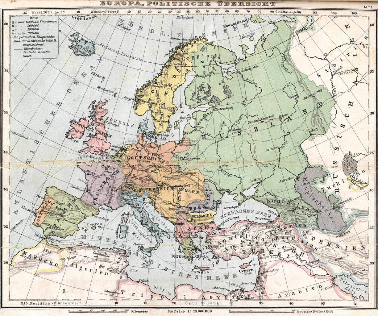
Αρχείο:Europa politisch 1905.png

Εικόνα σε υψηλότερη ανάλυση (1.600 × 1.338 εικονοστοιχεία, μέγεθος αρχείου: 1,37 MB, τύπος MIME: image/png)
|
|
Αυτό το αρχείο και η περιγραφή του προέρχονται από το Wikimedia Commons. Οι πληροφορίες από την σελίδα περιγραφής του εκεί εμφανίζονται παρακάτω. |
Σύνοψη
| Περιγραφή | Historical map of Europe (1905) |
| Ημερομηνία | |
| Πηγή | Bibliothek allgemeinen und praktischen Wissens für Militäranwärter Band I, 1905 / Deutsches Verlaghaus Bong & Co Berlin * Leipzig * Wien * Stuttgart |
| Δημιουργός | Scan made by Kogo |
| Άδεια (Επαναχρησιμοποίηση αυτού του αρχείου) |
Public Domain, because copyright expired |
_en.png)
.png)
.jpg)
Αδειοδότηση
|
Αυτό το έργο είναι κοινό κτήμα στη χώρα προέλευσής του και άλλες χώρες και περιοχές όπου η διάρκεια πνευματικών δικαιωμάτων είναι όσο η ζωή του δημιουργού και μέχρι 70 χρόνια μετά ή λιγότερο.
| |
| Αυτό το αρχείο έχει χαρακτηριστεί ως απαλλαγμένο από γνωστούς περιορισμούς βάσει της νομοθεσίας περί πνευματικής ιδιοκτησίας, περιλαμβανομένων όλων των συναφών και συγγενικών δικαιωμάτων. | |
Ιστορικό αρχείου
Κλικάρετε σε μια ημερομηνία/ώρα για να δείτε το αρχείο όπως εμφανιζόταν εκείνη τη στιγμή.
| Ώρα/Ημερομ. | Μικρογραφία | Διαστάσεις | Χρήστης | Σχόλια | |
|---|---|---|---|---|---|
| τελευταία | 10:02, 14 Αυγούστου 2006 | | 1.600 × 1.338 (1,37 MB) | Kogo | {{Information |Description=Historical map of Europe (1905) |Source=Bibliothek allgemeinen und praktischen Wissens für Militäranwärter Band I, 1905 / Deutsches Verlaghaus Bong & Co Berlin * Leipzig * Wien * Stuttgart |Author=Scan made by [[User:kogo|K |
Συνδέσεις αρχείου
Δεν υπάρχουν σελίδες που συνδέουν σε αυτό το αρχείο.
Καθολική χρήση αρχείου
Τα ακόλουθα άλλα wiki χρησιμοποιούν αυτό το αρχείο:
- Χρήση σε en.wikipedia.org
- Χρήση σε ms.wikipedia.org