
Αρχείο:Caucasus central asia political map 2000.jpg

Μέγεθος αυτής της προεπισκόπησης: 800 × 596 εικονοστοιχεία . Άλλες αναλύσεις: 320 × 239 εικονοστοιχεία | 640 × 477 εικονοστοιχεία | 1.024 × 763 εικονοστοιχεία | 1.280 × 954 εικονοστοιχεία | 1.390 × 1.036 εικονοστοιχεία.
Εικόνα σε υψηλότερη ανάλυση (1.390 × 1.036 εικονοστοιχεία, μέγεθος αρχείου: 164 KB, τύπος MIME: image/jpeg)
|
|
Αυτό το αρχείο και η περιγραφή του προέρχονται από το Wikimedia Commons. Οι πληροφορίες από την σελίδα περιγραφής του εκεί εμφανίζονται παρακάτω. |
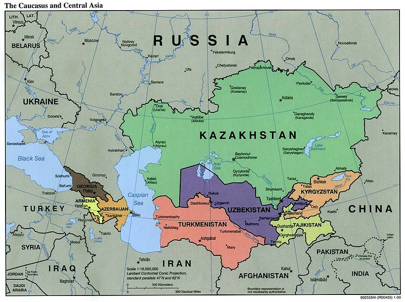
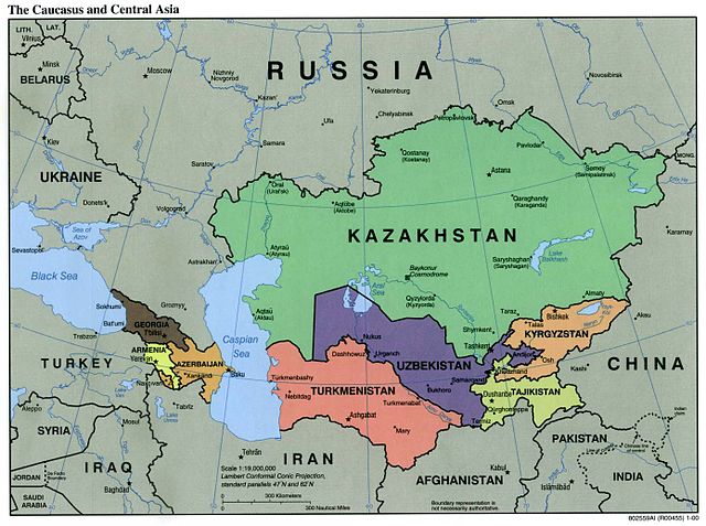
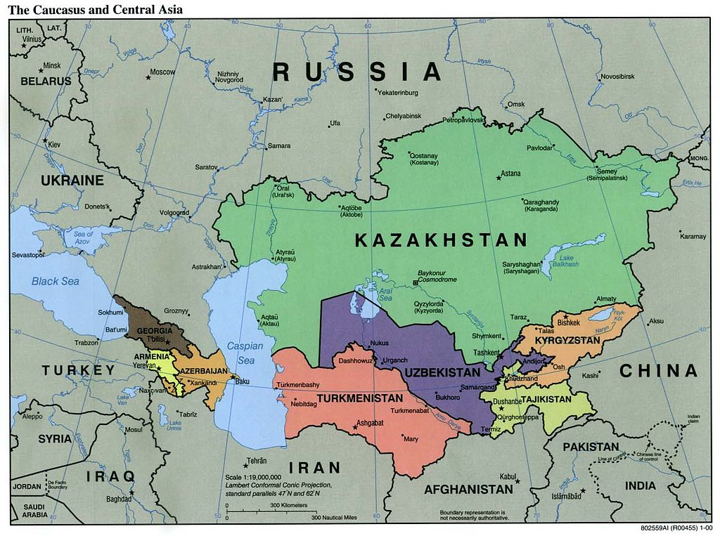
| Περιγραφή | Political Map of the Caucasus and Central Asia | ||||||
| Πηγή | http://ftp.lib.utexas.edu/maps/kazakhstan.html (CIA-Scans) | ||||||
| Δημιουργός | CIA | ||||||
| Άδεια (Επαναχρησιμοποίηση αυτού του αρχείου) |
|
||||||
| άλλες εκδόσεις | Derivative works of this file: Central Asia - political map.svg | ||||||

Ιστορικό αρχείου
Κλικάρετε σε μια ημερομηνία/ώρα για να δείτε το αρχείο όπως εμφανιζόταν εκείνη τη στιγμή.
| Ώρα/Ημερομ. | Μικρογραφία | Διαστάσεις | Χρήστης | Σχόλια | |
|---|---|---|---|---|---|
| τελευταία | 01:20, 9 Νοεμβρίου 2004 | | 1.390 × 1.036 (164 KB) | Annalog~commonswiki | The Caucasus and Central Asia Political Map 2000 |
Συνδέσεις αρχείου
Δεν υπάρχουν σελίδες που συνδέουν σε αυτό το αρχείο.
Καθολική χρήση αρχείου
Τα ακόλουθα άλλα wiki χρησιμοποιούν αυτό το αρχείο:
- Χρήση σε en.wikipedia.org
- Χρήση σε es.wikipedia.org
- Χρήση σε id.wikipedia.org
- Χρήση σε jv.wikipedia.org
- Χρήση σε min.wikipedia.org
- Χρήση σε ml.wikipedia.org
- Χρήση σε ro.wikipedia.org
- Χρήση σε te.wikipedia.org
- Χρήση σε th.wikipedia.org
- Χρήση σε tl.wikipedia.org
- Χρήση σε zh-min-nan.wikipedia.org