
Αρχείο:Victoria locator-MJC.png
Δεν διατίθεται υψηλότερη ανάλυση.
Victoria_locator-MJC.png (563 × 476 εικονοστοιχεία, μέγεθος αρχείου: 12 KB, τύπος MIME: image/png)
|
|
Αυτό το αρχείο και η περιγραφή του προέρχονται από το Wikimedia Commons. Οι πληροφορίες από την σελίδα περιγραφής του εκεί εμφανίζονται παρακάτω. |

|
This locator map image could be re-created using vector graphics as an SVG file. This has several advantages; see Commons:Media for cleanup for more information. If an SVG form of this image is available, please upload it and afterwards replace this template with
{{vector version available|new image name}}.
It is recommended to name the SVG file “Victoria locator-MJC.svg”—then the template Vector version available (or Vva) does not need the new image name parameter. |
Σύνοψη
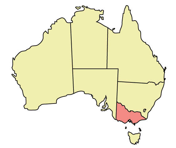
Map of Australia highlighting Victoria
Made in Adobe Illustrator by Martynam and released under the GFDL
Αδειοδότηση
| Το αρχείο διανέμεται υπό την άδεια Creative Commons Αναφορά προέλευσης-Παρόμοια διανομή 3.0 Μη εισαγόμενη Με τους όρους των αποποίηση ευθυνών. | ||
| ||
| Αυτή η ετικέτα άδειας χρήσης προστέθηκε στο αρχείο ως μέρους της αναθεώρησης της άδειας GFDL . |

|
Παραχωρείται η άδεια προς αντιγραφή, διανομή και/ή τροποποίηση αυτού του εγγράφου υπό τους όρους της Άδειας Ελεύθερης Τεκμηρίωσης GNU, Έκδοση 1.2 ή οποιασδήποτε νεότερης έκδοσης δημοσιευμένης από το Ίδρυμα Ελεύθερου Λογισμικού· χωρίς Απαράλαχτους Τομείς, χωρίς Κείμενα Εξωφύλλου, και χωρίς Κείμενα Οπισθοφύλλου. Αντίγραφο της άδειας περιλαμβάνεται στην σελίδα με τίτλο GNU Free Documentation License. Με τους όρους των αποποίηση ευθυνών. |
Ιστορικό αρχείου
Κλικάρετε σε μια ημερομηνία/ώρα για να δείτε το αρχείο όπως εμφανιζόταν εκείνη τη στιγμή.
| Ώρα/Ημερομ. | Μικρογραφία | Διαστάσεις | Χρήστης | Σχόλια | |
|---|---|---|---|---|---|
| τελευταία | 22:49, 30 Δεκεμβρίου 2005 | | 563 × 476 (12 KB) | Snowdog | Map of Australia highlighting Victoria Made in Adobe Illustrator by Martynam and released under the GFDL Category:Maps of Australia |
Συνδέσεις αρχείου
Δεν υπάρχουν σελίδες που συνδέουν σε αυτό το αρχείο.
Καθολική χρήση αρχείου
Τα ακόλουθα άλλα wiki χρησιμοποιούν αυτό το αρχείο:
- Χρήση σε af.wikipedia.org
- Χρήση σε ar.wikipedia.org
- Χρήση σε be.wikipedia.org
- Χρήση σε ckb.wikipedia.org
- Χρήση σε cs.wikipedia.org
- Χρήση σε cy.wikipedia.org
- Χρήση σε de.wikipedia.org
- Χρήση σε en.wikipedia.org
- City of Maroondah
- Hobsons Bay
- Paisley railway station, Melbourne
- Galvin railway station
- Williamstown Pier railway station
- Chum Creek, Victoria
- Don Valley, Victoria
- Gruyere, Victoria
- Kalorama, Victoria
- Launching Place, Victoria
- Macclesfield, Victoria
- Menzies Creek, Victoria
- Seville, Victoria
- Seville East, Victoria
- Sherbrooke, Victoria
- Tremont, Victoria
- Yellingbo, Victoria
- Cranbourne South, Victoria
- Narre Warren East, Victoria
- Warneet, Victoria
- Dandenong North, Victoria
- Dandenong South, Victoria
- Noble Park North, Victoria
- Skye, Victoria
- Blairgowrie, Victoria
- Boneo, Victoria
- Main Ridge, Victoria
- Merricks North, Victoria
- Red Hill, Victoria
- Red Hill South, Victoria
- Capel Sound, Victoria
- Simpson Barracks
- Yallambie
- Attwood, Victoria
- Coolaroo, Victoria
- Oaklands Junction, Victoria
- Somerton, Victoria
- Burnside, Victoria
- Hillside, Victoria
- Kurunjang
- Rockbank, Victoria
- Ardeer, Victoria
- Calder Park, Victoria
Δείτε περισσότερη καθολική χρήση αυτού του αρχείου.