
Αρχείο:Mobile Alabama harbor aerial view.jpg
Μέγεθος αυτής της προεπισκόπησης: 800 × 533 εικονοστοιχεία . Άλλες αναλύσεις: 320 × 213 εικονοστοιχεία | 640 × 426 εικονοστοιχεία | 1.024 × 682 εικονοστοιχεία | 1.500 × 999 εικονοστοιχεία.
Εικόνα σε υψηλότερη ανάλυση (1.500 × 999 εικονοστοιχεία, μέγεθος αρχείου: 664 KB, τύπος MIME: image/jpeg)
|
|
Αυτό το αρχείο και η περιγραφή του προέρχονται από το Wikimedia Commons. Οι πληροφορίες από την σελίδα περιγραφής του εκεί εμφανίζονται παρακάτω. |
| Περιγραφή |
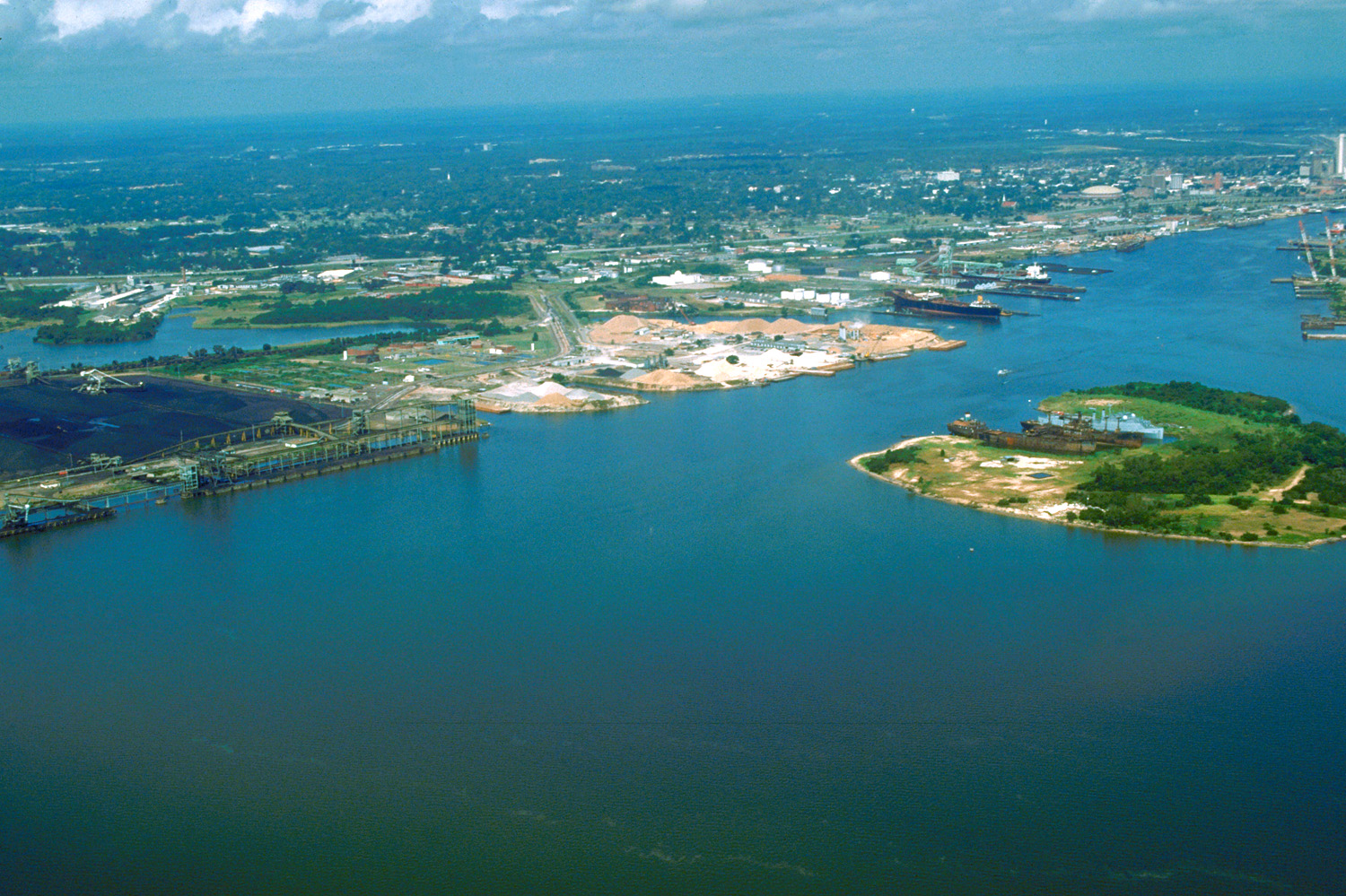
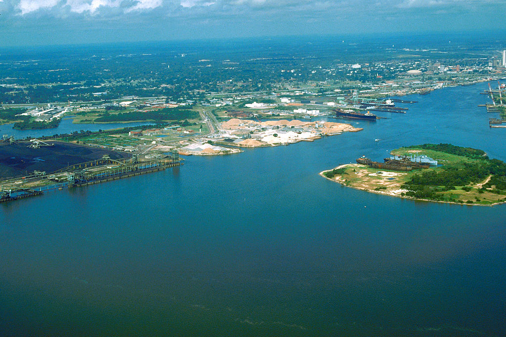
English: Aerial view of the port and city of Mobile, Alabama, USA. The view is from the harbor on Mobile Bay to the northwest over the central area of the city. |
|||
| Location | Mobile, Alabama, USA 30°39′47.39″N 88°1′59.79″W / 30.6631639°N 88.033275°W |
|||
| Ημερομηνία | (Caution: Dates provided by U.S. Army Corps of Engineers web pages are not reliable and are often wrong.) | |||
| Πηγή |
U.S. Army Corps of Engineers Digital Visual Library Image page Image description page Digital Visual Library home page |
|||
| Δημιουργός | Adrien Lamarre, U.S. Army Corps of Engineers | |||
| Άδεια (Επαναχρησιμοποίηση αυτού του αρχείου) |
|
Ιστορικό αρχείου
Κλικάρετε σε μια ημερομηνία/ώρα για να δείτε το αρχείο όπως εμφανιζόταν εκείνη τη στιγμή.
| Ώρα/Ημερομ. | Μικρογραφία | Διαστάσεις | Χρήστης | Σχόλια | |
|---|---|---|---|---|---|
| τελευταία | 01:30, 25 Απριλίου 2007 | | 1.500 × 999 (664 KB) | DanMS | {{Information2 | Description = {{en|Aerial view of the port and city of Mobile, Alabama, USA. The view is from the harbor on Mobile Bay to the northwest over the central area of the city.}} | Source = U.S. Army Corps of Engineers Digital Visual |
Συνδέσεις αρχείου
Τα παρακάτω λήμματα συνδέουν σε αυτό το αρχείο:
Καθολική χρήση αρχείου
Τα ακόλουθα άλλα wiki χρησιμοποιούν αυτό το αρχείο:
- Χρήση σε bo.wikipedia.org
- Χρήση σε en.wikipedia.org
- Χρήση σε es.wikipedia.org
- Χρήση σε eu.wikipedia.org
- Χρήση σε fa.wikipedia.org
- Χρήση σε fr.wikipedia.org
- Χρήση σε hsb.wikipedia.org
- Χρήση σε ja.wikipedia.org
- Χρήση σε mk.wikipedia.org
- Χρήση σε nl.wikipedia.org
- Χρήση σε pl.wikipedia.org
- Χρήση σε ru.wikipedia.org
- Χρήση σε tr.wikipedia.org
- Χρήση σε www.wikidata.org
- Χρήση σε zh.wikipedia.org