Atlas of Romania
Specific status: Akrotiri and Dhekelia‡ · Faroe Islands · Gibraltar · Bailiwick of Guernsey · Isle of Man · Jersey · Svalbard – Limited recognition: Abkhazia‡ · Gagauzia · Kosovo · South Ossetia‡ · Transnistria · Northern Cyprus‡
‡: partly located in Europe

|
Wikimedia Commons Atlas of the World The Wikimedia Atlas of the World is an organized and commented collection of geographical, political and historical maps available at Wikimedia Commons. Discussion • Update the atlas • Index of the Atlas • Atlas in categories • Other atlases on line |
|
| ||||||||||||||||||||||||||||||||||||||||||||
General maps

|
Hartă generală a României Übersichtskarte von Rumänien General map of Romania Carte générale de la Roumanie |

|
Harta fizică şi generală a României Physical and general map Carte physique et générale de la Roumanie |
|
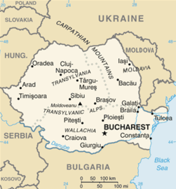
Harta României Karte von Rumänien Map of Romania Carte de la Roumanie |

|
Harta României Map of Romania in Romanian Carte de la Roumanie en langue Roumaine |

|
Románia térkép Harta României în limba maghiară. Same map in Hungarian Même carte en hongrois |

|
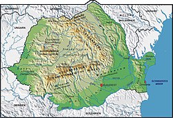
Hartă topografică a României Relief map of Romania |
|
Harta fizică Physical map |

|
Câmpia Dunării Walachische Tiefebene The Walachian Plain La plaine de Valachie |

|
Harta hidrografică a României Karte der Flüsse in Rumänien Rivers map Carte des fleuves en Roumanie |

|
Topographic map |

|
Mountains of Romania |

|
The Eastern Carpathian mountains |

|
The Turning Carpathian mountains |

|
The Southern Carpathian (Transylvanian Alpine) mountains |

|
The Western Carpathian mountains (Apuseni or Bihor, and Banat ranges) |

|
The Harghita volcanic mountains |

|
The hercynian Măcin range in Dobruja, Romania |
|
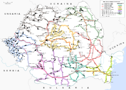
Romanian railway system |

|
Romanian national roads |

|
Historical regions |

|
Historical regions coloured |

|
Regions of Greater Romania with counties of 1930 |
|
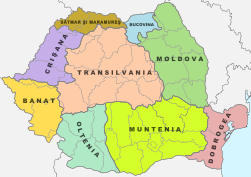
Historical regions within contemporary Romania |
-
Transylvania, Banat, Crişana and Maramureş in Romania
-
Banat in Romania
-
Transylvania in Romania
-
Crişana in Romania
-
Maramureş in Romania
-
Dobrudja in Romania
-
Wallachia in Romania
-
Oltenia in Romania
-
Oltenia in Walachia
-
Muntenia in Romania
-
Muntenia in Walachia
-
Moldavia and Bucovina in Romania
-
Moldavia in Romania
-
(Southern) Bucovina in Romania
Maps of divisions
This section holds maps of the administrative divisions.

|
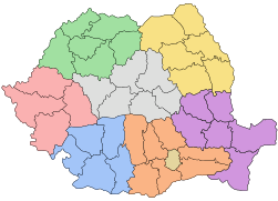
Euro-Regions |
|
Development regions and counties |
-
Centru development region
-
Nord-Est development region
-
Nord-Vest development region
-
Sud development region
-
Sud-Est development region
-
Sud-Vest development region
-
Vest development region

|
Counties of Romania with their capital cities |

|
Counties of Romania |

|
The counties with their capital cities |
-
Alba county
-
Arad county
-
Argeş county
-
Bacău county
-
Bistriţa-Năsăud county
-
Bihor county
-
Botoşani county
-
Brăila county
-
Braşov county
-
Buzău county
-
Călăraşi county
-
Caraş-Severin county
-
Cluj county
-
Constanţa county
-
Covasna county
-
Dâmboviţa county
-
Dolj county
-
Galaţi county
-
Giurgiu county
-
Gorj county
-
Harghita county
-
Hunedoara county
-
Ialomiţa county
-
Iaşi county
-
Ilfov county
-
Maramureş county
-
Medehinţi county
-
Mureş county
-
Neamţ county
-
Olt county
-
Prahova county
-
Sălaj county
-
Satu Mare county
-
Sibiu county
-
Suceava county
-
Teleorman county
-
Timiş county
-
Tulcea county
-
Vâlcea county
-
Vaslui county
-
Vrancea county
-
Bucharest municipality

|
Communes of Romania |

|
Administrative map of the Romanian Orthodox Church |

|
Administrative map of the Romanian Greek-Catholic (Uniate) Church |

|
Administrative map of the Romanian Roman-Catholic Church |
History maps
This section holds a short summary of the history of the area of present-day Romania, illustrated with maps, including historical maps of former countries and empires that included present-day Romania.

|
The Thraco-Illyrians |

|
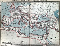
Territorial development of the Roman Empire 264 BC-192, including the conquest of Dacia |
|
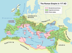
The Roman empire at its greatest extend |
|
The Roman Empire in 117 |

|
The extent of the Roman Republic and Roman Empire; 133 BC 44 BC (late Republic, after conquests by republican generals) AD 14 (death of Augustus) 117 (maximum extension)
|
|
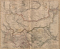
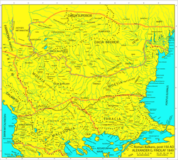
Roman era Balkans |
|
Roman era Balkans |

|
Dacia 82 B.C. |
|
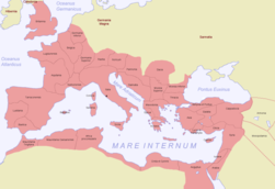
Map of the Roman Empire in 116 |

|
Dacia in the Roman Empire (116)) |

|
Moesia Inferior in the Roman Empire (116)) |

|
Roman Empire in 117 |

|
Dacia in the Roman Empire |

|
The roman province Dacia |

|
Kingdom of the Gepids in the 6th century (539-551) |

|
Origins of the Romanians |
|
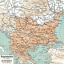
The vlach-bulgarian kingdom under Ivan Assen/Ioan Asan II, 1218-41 |

|
The campaigns of Ivan Assen/Ioan Asan II |

|
The wallachian & bulgarian states under the Tsar Todor Svetoslav (1307) |

|
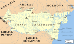
Principality of Walachia XIV - XVth century |
|
Principality of Walachia during Mircea the Elder (after 1404) |

|
Amlaş and Făgăraş duchies XIVth-XVth centuries |

|
Growth of the Ottoman Empire, without differentiation between the christian vassal states and the turkish provinces |

|
Development of the European part of the Ottoman Empire |

|
Growth of the Ottoman Empire, without differentiation between the christian vassal states and the turkish provinces |

|
Principality of Moldavia |

|
Principality of Moldavia during Stephen the Great (1457 - 1504) |

|
Romanian principalities 1600 |

|

|
Romanian principalities and Ottoman eyalets in 1683 |
|
Habsburg Empire during the 18th century |

|
Romanian principalities 1793-1812 |

|
Romanian principalities 1793-1812 |

|
Map of the Ottoman Empire 1801 |

|
Bukovina as a part of Galicia, the autonomous Transylvania and the Turkish/Russian Moldovas |

|
The Balkans after 1856 |

|
Romanian principalities 1856-1859 |

|
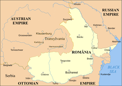
Romania (1868) in the context of "modern Dacia" |
|
Romania 1859-1878 |

|
Romania 1878, compared to interwar Romania |

|
Romania in 1879 (German) |

|
The Northwestern Black Sea basin in 1886 |

|
Romania in 1886 (French/Romanian) |

|
Romania in 1891 |

|
Romania in 1897 (Hungarian) |

|
Romania in 1898 (French) |

|
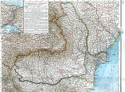
Romania in 1903 (Polish) (together with Serbia and Bulgaria) |
|
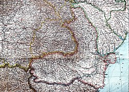
Romania in 1901 (German) |

|
Romania in 1905 (German) |

|
Citizens of Romania (1899) |

|
Soil map and climate map of Romania before the First World War |

|
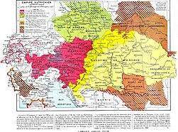
Romanian-populated regions in Austria-Hungary at the beginning of the 20th century |

|
Historical map of Austria-Hungary from the Bibliothek allgemeinen und praktischen Wissens für Militäranwärter Band I, 1905 |

|
Austria-Hungary and Romania before 1913 (Norvegian) |

|
Austria-Hungary and Romania before 1913, ethnic map (Romanian) |
|
Romania 1913-1916/18 |

|
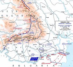
Romanian Campaign (World War I) |
|

|

|
Central Powers' offensive in Romania, 1916 |

|
WWI in Romania, 1916 (spanish) |
|
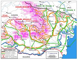
WWII in Romania, 1944 (spanish) |

|
The Allied offensive on Southern Central Europe |
|
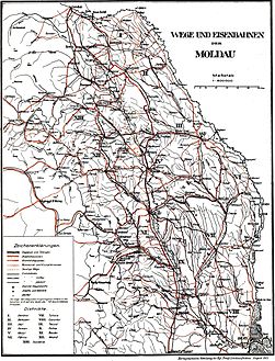
Railway map of the region of Moldova in 1917. |

|
Romanian borders according to the Bucharest Peace Treaty (May 1918) and than to WWI Peace Treaties (1919-1920) |

|
Territorial development in the twentieth century |

|
Romania in 1924 |

|
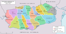
Wallachian counties during XIVth - XVIth centuries |
| [[|border|251x400px]] | Counties, 1480 |
|
Counties of Wallachia between 1601 and 1718 |

|
Counties of Moldavia between 1601 and 1718 |
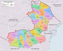
|
Counties of Wallachia and Moldavia in 1800, according with N. Iorga and C. Giurescu |

|
Counties of Romania between 1856 and 1878 |

|
Counties of Romania between 1878 and 1913 |

|
Counties of Romania between 1919 and 1925 |
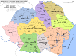
|
The original proposal for the administrative unification of interwar Romania (Simion Mehedinţi Commission, 1920) |

|
Counties and regions of Romania before 1926 |

|
Romania 1918—1940, Administrative map (after 1926) |

|
The 70 counties of Romania between 1936 and 1939 |

|
Interwar Romania (administrative map) |

|
Physical map of Romania 1926-1929 |

|
Romania in 1930. Administrative map including the counties, the towns and the county subdivisions (plăşi) |

|
Romania in 1938. Administrative map including the counties, the towns and the county subdivisions (plăşi) |
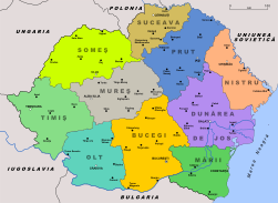
|
Romania 1939, Administrative map |
-
Former Alba county
-
Former Arad county
-
Former Argeş county
-
Former Bacău county
-
Former Baia county
-
Former Bălţi county
-
Former Bihor county
-
Former Botoşani county
-
Former Brăila county
-
Former Braşov county
-
Former Buzău county
-
Former Cahul county
-
Former Caliacra county
-
Former Caraş county (after 1926)
-
Former Caraş-Severin county (until 1926)
-
Former Câmpulung county
-
Former Cernăuţi county
-
Former Cetatea Albă county
-
Former Ciuc county
-
Former Cluj county
-
Former Constanţa county
-
Former Covurlui county
-
Former Dâmboviţa county
-
Former Dolj county
-
Former Dorohoi county
-
Former Durostor county
-
Former Făgăraş county
-
Former Fălciu county
-
Former Gorj county
-
Former Hotin county
-
Former Hunedoara county
-
Former Ialomiţa county
-
Former Iaşi county
-
Former Ilfov county
-
Former Ismail county
-
Former Lăpuşna county
-
Former Maramureş county
-
Former Mehedinţi county
-
Former Mureş county
-
Former Muscel county
-
Former Năsăud county
-
Former Neamţ county
-
Former Odorhei county
-
Former Olt county
-
Former Orhei county
-
Former Prahova county
-
Former Putna county
-
Former Rădăuţi county
-
Former Râmnicu Sărat county
-
Former Roman county
-
Former Romanaţi county
-
Former Sălaj county
-
Former Satu Mare county
-
Former Severin county (after 1926)
-
Former Sibiu county
-
Former Someş county
-
Former Soroca county
-
Former Storojineţ county
-
Former Suceava county
-
Former Târnava Mare county
-
Former Târnava Mică county
-
Former Tecuci county
-
Former Teleorman county
-
Former Tighina county
-
Former Timiş-Torontal county
-
Former Trei Scaune county
-
Former Tulcea county
-
Former Turda county
-
Former Tutova county
-
Former Vâlcea county
-
Former Vaslui county
-
Former Vlaşca county
-
Former Tinutul Arges
-
Former Tinutul Crisuri
-
Former Tinutul Dunarii
-
Former Tinutul Jiu
-
Former Tinutul Marii
-
Former Tinutul Mures
-
Former Tinutul Nistru
-
Former Tinutul Prut
-
Former Tinutul Suceava
-
Former Tinutul Timis
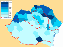
|
Jewish communities in 1930 |

|
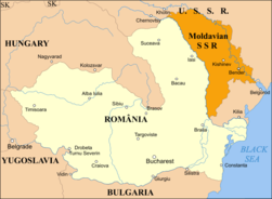
Romania in September 1940, administrative map |
|
Romania 1940-1941 |

|
Romania 1941 |
|
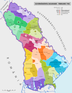
Administrative map of the Governorate of Bessarabia (in existence between 1941 and 1944). |

|
Romania controlled (August 19, 1941 - January 29, 1944) the whole "Transnistrian" region between Dniester, Bug rivers and Black Sea coast. The region was divided into 13 judeţe (counties). |

|
Transylvania as part of Hungary |

|
Romania 1942 |

|
Administrative map of Romania in 1942 |

|
Administrative map of Romania, 1950-1952 |

|
Administrative map of Romania, 1952-1956 |

|
Administrative map of Romania, 1960-1968 |
|
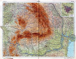
Romania in 1967 |

|
Proposed administrative reorganisation of the teritory of Romania, 1968 |
|
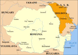
Romania 2000 |
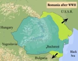
|
Romania after WW II |

|
Romania 1947 |
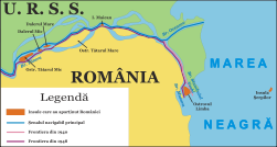
|
Danube Delta 1940 - 1948 |

|
Romania's Anticommunist Resistance 1948-1960 |

|
A hypotetical map of Romania united with Moldova, as it is demanded by the unionist movement |
| [[|border|251x400px]] | The so-called "Belkovski proposal": a political union excluding Transnistria |
Historical maps on Transylvania

|
Magyars in Transylvania |
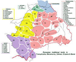
|
Traditional ethnographic romanian lands of Transylvania & Partium. |
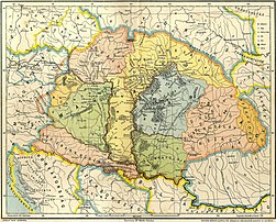
|
Duchies of Gelu, Glad and Menumorut according to the Gesta Hungarorum (9th century) |
| [[|border|251x400px]] | East-Hungarian kingdom & Principality of Transylvania in the XII century. |
| [[|border|251x400px]] | East-Hungarian kingdom & Principality of Transylvania in the XIII century. |
| [[|border|251x400px]] | East-Hungarian kingdom & Principality of Transylvania in the XV - XVII centuries. |

|
Transylvania in the 13th century |
| [[|border|251x400px]] | East-Hungarian kingdom & Principality of Transylvania in the XVI century |

|
Emigration of the Szeklers |

|
Banate of Severin, 13th century |

|
Transylvania in the 13th century |

|
Transylvania in the 16th century |

|
Transylvania in 1570 |

|
Kingdom of Hungary in 1550 |
|
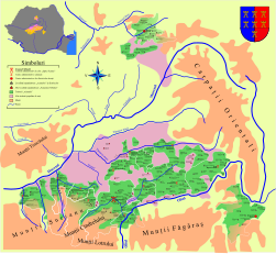
The seats of the Transylvanian Saxons |

|
Comitates, Szeklerland and Saxonland in Transylvania |

|
The Transylvanian Principality in 1857 |

|
The Transylvanian Principality in 1862 |

|
Administrative division of Transylvania, 1300-1867 |
|
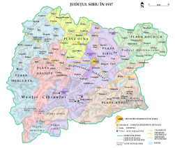
Sibiu County (South-Central Transylvania) in 1937 |

|
Northern Transylvania annexed to Hungary in World War II |

|
Magyar Autonomous Region in 1952 |

|
Magyar and Mureş-Magyar Autonomous Regions (1952-1968) |

|
Ethnic Hungarians in Romania |
|
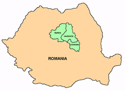
Szekely Land |
Dobruja (Dobrogea)
|
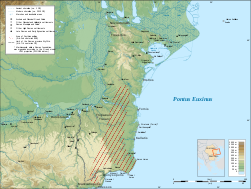
Scythia Minor |

|
Scythia Minor |
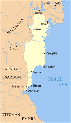
|
Principality of Dobrotici cca 1370 |

|
Principality of Dobrotici cca 1385 |
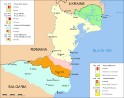
|
Historical borders in Dobruja |
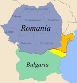
|
Map of Romania and Bulgaria with Dobruja highlighted |

|
The fronteer between Northern and Southern Dobruja |

|
Counties of Dobruja (1878-1879) |
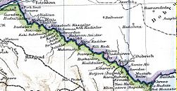
|
The fronteer between Romania and Bulgaria (1913-1940) |
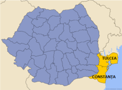
|
The counties of Northern Dobruja |
Banat

|
detailed map of the south-eastern part of Pannonian Sea (including area of modern Banat) during the Miocene Epoch |
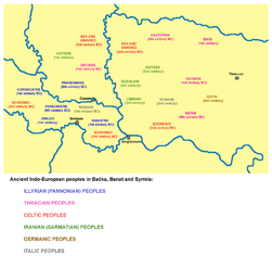
|
Indo-European peoples in Banat in ancient times |

|
Roman province of Dacia and Roman cities in Banat (2nd century) |

|
Lands ruled by Buta-ul, 8th century |

|
Voivodship of Glad, 9th century |

|
Voivodship of Ahtum, 11th century |
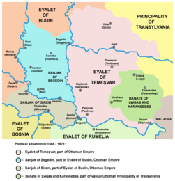
|
Eyalet of Temeşvar, and Banate of Lugos and Karansebes in 1568 |
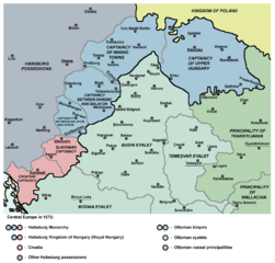
|
Eyalet of Temeşvar in 1572 |
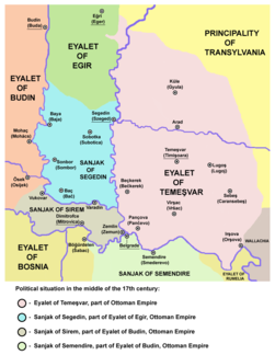
|
Elayet of Temeşvar in the middle of the 17th century |

|
Eyalet of Temeşvar in 1699 |

|
Banat of Temeswar in 1718 |

|
Banat of Temeswar in 1739 |

|
Banat of Temeswar in 1745 |

|
Banat of Temeswar in 1751-1778 |
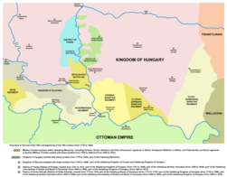
|
Vlach (Romanian) Banatian regiment in the end of the 18th century |
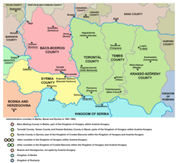
|
Counties in Bačka, Banat and Srem in 1881 |

|
Division of Banat between Vojvodina and Transylvania (proposed by Aurel Popovici in 1906) |
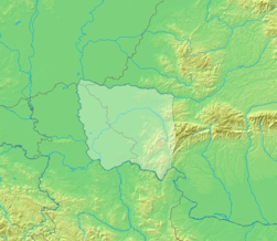
|
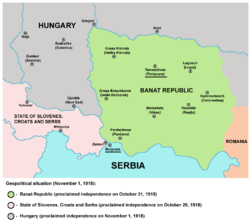
Banat Republic in 1918 |
|
Banat Republic in 1918 |

|
Republic of Banatia (proposed by Banatian Germans at a Paris Peace Conference in 1920) |
|
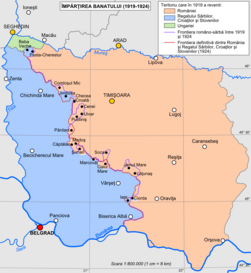
The dividing of Banat (1919-1923) |
Moldavia

|
The principality of Moldavia in 1483, during the reign of Stephen the Great (1457-1504) |

|
The regions of the historical principality of Moldavia, with the distribution of these regions to modern states |

|
Ethnic map of Hotin County (northern Bessarabia) in 1844 |

|
Ethnic map of Hotin County (northern Bessarabia) in 1930 |
Bukovina
|
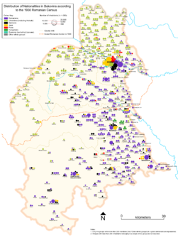
Ethnic map of Bukovina in 1930 |
|
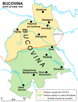
The division of Bukovina after the Soviet occupation of the northern half of the province in 1940 |

|
Administrative map of the Governorate of Bukovina in May 1942. |
|
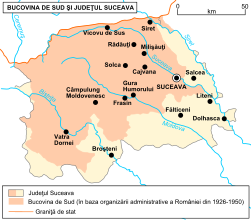
Southern Bukovina within the modern Suceava County |
Old Maps

|
Transylvania in 1532, by Johannes Honter |

|
Romania in 1543, by Johannes Honter |

|
Johann Sambucus, Map of Transsylvania |

|
Map of Moldova, 16th century |

|
Moldova by Dimitrie Cantemir, 1716 |

|
Walachia and Romania |
|
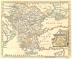
Balkans, by T. Jefferys, 1785 |

|
The oldest known hypotetical map of Rumania (1816) |

|
A hypotetical map of Rumania from 1855 |
|
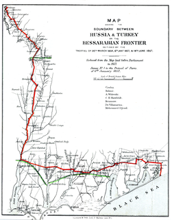
The southwestern Bessarabian frontier between 1856 and 1978 |
-
The 54 files of the Charta Principateloru Unite ale României (Bucharest, 1860, by George Filipescu-Dubau & Anton Parteni-Antoninu)
-
"Charta Principateloru Unite ale României" -file 1
-
idem -file 2- Oaş (Ugocea)
-
idem -file 3- Maramureş
-
idem -file 4- Bihor/Sălaj
-
idem -file 5- Șimleu/Zalău
-
idem -file 6- Dej/Bistriţa
-
idem -file 7- North-Western Bucovina
-
idem -file 8- North-Eastern Bucovina
-
idem -file 9- Northern Bessarabia
-
idem -file 10- South-Western Bucovina
-
idem -file 11- South-Eastern Bucovina
-
idem -file 12- Iaşi and around
-
idem -file 13- Soroca and around
-
idem -file 14- Statistics and Legend
-
idem -file 15- Legend
-
idem -file 16- Bălţi/Orhei
-
idem -file 17- Chişinău/Dubăsari and Statistics
-
idem -file 18- Statistics
-
idem -file 19- Eastern Bihor
-
idem -file 20- Cluj/Moţs county/Alba-Iulia
-
idem -file 21- Country of the Târnave rivers
-
idem -file 22- Caransebeş/Mehadia
-
idem -file 23- Hunedoara/Haţeg country/Târgu-Jiu
-
idem -file 24- Sibiu/Râmnicu-Vâlcea
-
idem -file 25- Western Székely county
-
idem -file 26- Eastern Székely & Csángó counties/Piatra-Neamţ
-
idem -file 27- Roman/Vaslui/Bârlad
-
idem -file 28- Braşov/Câmpulung/Câmpina
-
idem -file 29- Covasna/Vrancea/Buzău
-
idem -file 30- Tecuci/Focşani/Râmnicu-Sărat
-
idem -file 31- Hânceşti/Huşi/Leova/Comrat
-
idem -file 32- Chişinău/Tighina-Bender/Căuşeni
-
idem -file 33- Mouths of the Dniestr
-
idem -file 34- Galaţi/Reni/Bolgrad
-
idem -file 35- Izmail/Chilia/Chilia & Sulina branchs
-
idem -file 36- Tuzla in Budzak/Snakes Is.
-
idem -file 37- Orşova/Turnu-Severin/Vidin/Iron Gates
-
idem -file 38- Central Oltenia/Craiova
-
idem -file 39- Piteşti/Slatina/Caracal
-
idem -file 40- North-Western Bulgaria in the Ottoman Empire
-
idem -file 41- North-Western Bulgaria/Danube
-
idem -file 42- Islaz/Turnu-Măgurele/Danube/Northern Bulgaria
-
idem -file 43- Central Muntenia/Târgovişte/Vlaşca county
-
idem -file 44- Bucharest/Ploieşti/Olteniţa
-
idem -file 45- Slobozia/Călăraşi/Bărăgan
-
idem -file 46- Alexandria/Zimnicea/Giurgiu
-
idem -file 47- Northern Bulgaria between Ruse/Tutrakan/Razgrad
-
idem -file 48- North-Eastern Bulgaria around Silistra
-
idem -file 49- Central Dobrudja
-
idem -file 50- North-Eastern Dobrudja/St-George branch and Statistics
-
idem -file 51- Statistics
-
idem -file 52- Southern Dobrudja around Mangalia
-
idem -file 53- Statistics
-
idem -file 54- Statistics
Ethno-linguistic maps

|
The spread of ethnic Romanians |

|
The 3 main subdivisions of the Daco-Romanians |

|
Romanian varieties |

|
Some representative isoglosses of three main varieties (dialects) of Daco-Romanian |
|
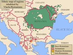
Vlachs in the Balkans |

|
Romanians in Romania (2002) |

|
Romanians in Romania (2011) by counties |

|
Romanians in Transylvania (1850) |

|
Hungarians in Romania, by communes and cities (2002) |

|
Hungarians in Transylvania (1850) |

|
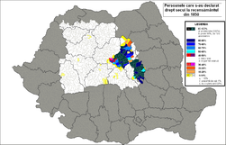
Declared Hungarians in Transylvania (1850) |
|
Declared Szekelys in Transylvania (1850) |

|
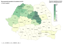
Hungarians in Romania, by counties (2002) |
|
Hungarians in Romania, by counties (2011) |

|
Hungarians in Transylvania, Banat, Crişana, Maramureş (2002) |
|
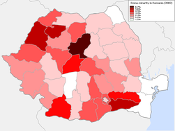
Roma (Gypsies) in Romania (2002) |

|
Roma (Gypsies) in Romania (2002) |

|
Roma (Gypsies) in Romania (2002) |

|
Roma (Gypsies) in Romania (2002) |

|
Roma (Gypsies) in Romania (2011) by counties |

|
Gypsies in Transylvania (1850) |

|
Germans in Romania (2002) |

|
Germans in Transylvania (1850) |

|
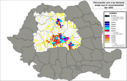
Declared Germans in Transylvania (1850) |
|
Declared Saxons in Transylvania (1850) |

|
Ukrainians in Romania (2002) |

|
Russians and Lipovans in Romania (2002) |

|
Turks in Romania (census 2002) |

|
Tatars in Romania (census 2002) |

|
Serbs in Romania (census 2002) |

|
Slovaks in Romania (census 2002) |

|
Bulgarians in Romania (census 2002) |

|
Croats in Romania (census 2002) |

|
Greeks in Romania (census 2002) |
|
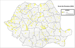
Jews in Romania (census 2002) |

|
Jews in Transylvania (1850) |

|
Czechs in Romania (census 2002) |
|
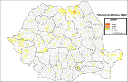
Poles in Romania (census 2002) |

|
Italians in Romania (census 2002) |

|
Armenians in Romania (census 2002) |

|
Armenians in Transylvania (1850) |

|
Eastern Orthodoxy in Romania (census 2002) |

|
Eastern Orthodoxy in Romania (census 1930) |

|
Eastern Orthodoxy in Transylvania (1850) |

|
Roman Catholicism in Romania (census 2002) |

|
Roman Catholicism in Romania (census 1930) |

|
Roman Catholicism in Transylvania (1850) |

|
Protestantism in Romania (census 2002) |

|
Protestantism in Romania (census 1930) |

|
Protestantism in Transylvania (1850) |

|
Reformed (Calvins) in Romania (census 2002) |

|
Reformed (Calvins) in Romania (census 1930) |

|
Reformed (Calvins) in Transylvania (1850) |

|
Pentecostals in Romania (census 2002) |

|
Greek Catholics in Romania (census 2002) |

|
Greek Catholics in Romania (census 1930) |

|
Greek Catholics in Transylvania (1850) |

|
Baptists in Romania (census 2002) |

|
Baptists in Romania (census 1930) |

|
Adventists in Romania (census 2002) |

|
Adventists in Romania (census 1930) |

|
Muslims in Romania (census 2002) |

|
Unitarians in Romania (census 2002) |

|
Unitarians in Romania (census 1930) |

|
Unitarians in Transylvania (1850) |

|
The United Brethrens in Romania (census 2002) |

|
The Old believers in Romania (census 2002) |

|
The distribution of the Lutherans (on the north of the Carpathians) and other Evangelical churches (on the south of the Carpathians) in Romania (census 2002) |

|
Lutherans in Romania (census 1930) |

|
Lutherans in Transylvania (1850) |

|
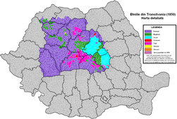
Ethnic groups in Transylvania (1850) |
|
Ethnic groups in Transylvania (1850) with Saxons and Szeklers |

|
Ethnic map of the European Turkey and its vassal states (1861) |
|
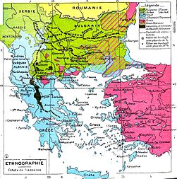
Ethnic map of the Balkan Peninsula (1898) |

|
Vlachs (Romanians) in Hungary, census 1890 |

|
Ethnic map of Austria-Hungary, census 1880. German version |
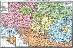
|
Ethnic map of Austria-Hungary, census 1890. English version |

|
Territories inhabited by Romanians in 1908 |

|
Territories inhabited by Romanians before the First World War |
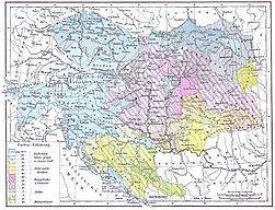
|
Religions of Austria-Hungary, including Transsylvania |

|
Linguistic map of Transylvania, Banat, Crisana, Satmar and Maramures in 1910 |
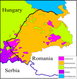
|
Historical ethnic map of Transylvania |
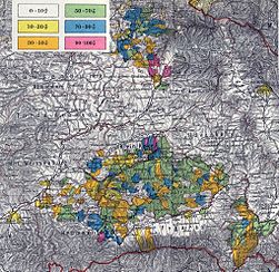
|
Transylvanian Saxon settlements (1890) |

|
The Lutheran church in Transylvania (1904) |

|
German-inhabited settlements in Southern Transylvania and the Romanian Banat in 1940 |

|
South Slavs in Romania |

|
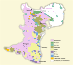
Ethnic map (1861). See also the legend |
|
Ethnic map (1903) |

|
Ethnic map (1918) |
|
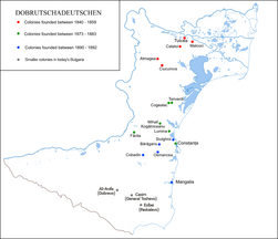
Dobruja Germans |

|
Ethnic map of Romania according to the 1930 census |
|
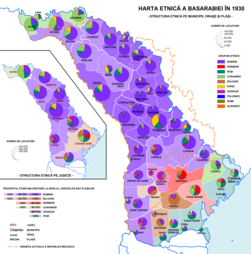
Ethnic map of Bessarabia according to the 1930 census |

|
Ethnic map of Romania (including Transnistria) in 1941 |

|
Ethnic composition of the (Romanian) Governorate of Bessarabia in 1941 |
|
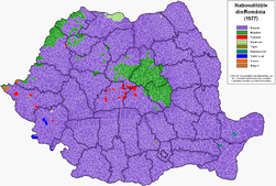
Ethnic map of Romania (census 1977) |

|
Ethnic map of Romania (census 1992) |

|
Ethnic map of Romania (census 2002) |

|
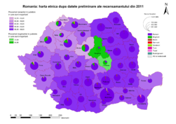
Ethnic map of Romania (census 2011) by communes and cities |
|
Ethnic map of Romania (census 2011) by counties |

|
Religious map of Romania (census 2002) |

|
Religious map of Romania (census 1930) |

|
Religions in Transylvania (1850) |

|
Foreign residents in Romania (census 2002) by country of citizenship |

|
Visa requirements for Romanian citizens |
Satellite maps

|
Satellite image of Romania in December 2001 |
Regional topographic maps
-
Topographic map of Dobruja
-
Protected areas of Dobruja
-
Topographic map of the area surrounding the city of Sibiu/Hermannstadt, Southern Transylvania (scale 1:100.000)
-
Topographic map of the area surrounding the town of Targu Neamt, Moldavia (scale 1:75.000)
Economy maps
-
Agriculture production (1898)
-
Oilfields in Romania (1900)
-
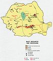
Romania - Basic Resources and Processing (1970)
-
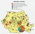
Industrial centers (1970)
-
Romanian economy (1990)
-
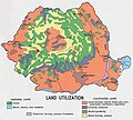
Romania - Land Utilization (1970)
-
Romania - Land Use (1990)
-
Income in Romania
-
Contributions to the Romanian budget
-
The waterway that connects the North Sea with the Black Sea
-
Illiteracy in Romania 2011
-
Literacy in Romania 1930
-
Crime map (2009)
-
Homicides in Romania
-
Suicides in Romania
-
Car accidents in Romania
-
Romanian Order of Architects
Election maps
-
Results of the 1937 general elections at county level
-
Results of the 2008 local elections at county and municipality level
-
Results of the 2008 legislative elections in the Senate constituencies within Romania
-
Results of the 2008 legislative elections in the Chamber of Deputies constituencies within Romania
Notes and references
|
General remarks:
|
