
Αρχείο:New Holland map by William Dampier 1699 - Project Gutenberg eText 15675.jpg

Εικόνα σε υψηλότερη ανάλυση (500 × 731 εικονοστοιχεία, μέγεθος αρχείου: 94 KB, τύπος MIME: image/jpeg)
|
|
Αυτό το αρχείο και η περιγραφή του προέρχονται από το Wikimedia Commons. Οι πληροφορίες από την σελίδα περιγραφής του εκεί εμφανίζονται παρακάτω. |
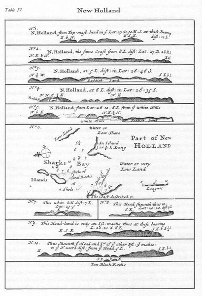
New Holland map by William Dampier, 1699 - Project Gutenberg eText 15675
From http://www.gutenberg.org/etext/15675/
| This image comes from the Project Gutenberg archives. This is an image that has come from a book or document for which the American copyright has expired and this image is in the public domain in the United States and possibly other countries.
This eBook is for the use of anyone anywhere at no cost and with almost no restrictions whatsoever. You may copy it, give it away or re-use it under the terms of the Project Gutenberg License included with this eBook or online at www.gutenberg.net. |
Ιστορικό αρχείου
Κλικάρετε σε μια ημερομηνία/ώρα για να δείτε το αρχείο όπως εμφανιζόταν εκείνη τη στιγμή.
| Ώρα/Ημερομ. | Μικρογραφία | Διαστάσεις | Χρήστης | Σχόλια | |
|---|---|---|---|---|---|
| τελευταία | 14:49, 12 Ιουνίου 2005 | | 500 × 731 (94 KB) | Tagishsimon | New Holland map by William Dampier, 1699 - Project Gutenberg eText 15675 From http://www.gutenberg.org/etext/15675/ {{PD}} Category:Maps |
Συνδέσεις αρχείου
Τα παρακάτω λήμματα συνδέουν σε αυτό το αρχείο:
Καθολική χρήση αρχείου
Τα ακόλουθα άλλα wiki χρησιμοποιούν αυτό το αρχείο:
- Χρήση σε ast.wikipedia.org
- Χρήση σε ckb.wikipedia.org
- Χρήση σε cs.wikipedia.org
- Χρήση σε de.wikipedia.org
- Χρήση σε en.wikipedia.org
- Χρήση σε eo.wikipedia.org
- Χρήση σε es.wikipedia.org
- Χρήση σε fa.wikipedia.org
- Χρήση σε fr.wikipedia.org
- Χρήση σε fy.wikipedia.org
- Χρήση σε gl.wikipedia.org
- Χρήση σε he.wikipedia.org
- Χρήση σε hu.wikipedia.org
- Χρήση σε it.wikipedia.org
- Χρήση σε ja.wikipedia.org
- Χρήση σε lv.wikipedia.org
- Χρήση σε ms.wikipedia.org
- Χρήση σε nl.wikipedia.org
- Χρήση σε ru.wikipedia.org
- Χρήση σε sk.wikipedia.org
- Χρήση σε ta.wikipedia.org
- Χρήση σε th.wikipedia.org
- Χρήση σε uk.wikipedia.org