Nederland - Koninkrijk der Nederlanden Nederland is een West-Europees land, begrensd door de Noordzee, Duitsland en België. De hoofdstad van het land is Amsterdam, de regeringszetel is Den Haag. Andere belangrijke steden zijn: Rotterdam, met een van de grootste havens van de wereld, Utrecht, het verkeersknooppunt van het land, Groningen (vooral voor het noorden) en Eindhoven, de vijfde stad van het land. Per 10 oktober 2010 is het tevens een Caribisch land, doordat Bonaire, Saba en Sint Eustasius onderdeel van Nederland zijn geworden. Het land Nederland is, net zoals Aruba, Curaçao en Sint Maarten, een deelstaat van het Koninkrijk der Nederlanden.
Nederlân - Nederlân is in lân yn West-Jeropa, mei 16.300.000 ynwenners, en mei in oerflak fan 41.526 km² (wêrfan 7644.94 km² wetter). De haadstêd is Amsterdam. Nederlân wurdt begrinzge troch: de Noardsee yn it westen en noarden; Dútslân yn it easten; Belgje yn it súden.
The Netherlands is the European and Caribean part of the Kingdom of the Netherlands,[2] which consists of the Netherlands, Aruba, Curaçao and Sint Maarten. The Netherlands is a constitutional monarchy, located in northwestern Europe. It is bordered by the North Sea to the north and west, ► Belgium (► Flanders and a small piece of ► Wallonia) to the south, and ► Germany to the east. The current borders were established in 1839. To the Kingdom belong also ► Aruba and the former ► Netherlands Antilles.[3]
Short name
The Netherlands
Official name
Kingdom of the Netherlands
Status
Independent country since 1581, recognized 1648, member of the ► European Union since 1957
Location
Western Europe
Capital
Amsterdam (de jure), Den Haag (The Hague, de facto[4])
This section holds maps of the administrative divisions.
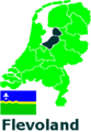
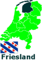
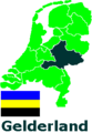
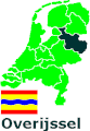
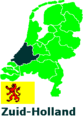
The Netherlands are divided in 12 provinces. The names of the provinces are shown in this map, but the official name of Friesland, which is a Dutch name, is Fryslân, a Frisian name. (Provincies van Nederland. De officiële naam van Friesland is Fryslân)
German map
French map
Dutch map
Location and name of the provincies
The provinces are further divided in municipalities. (Nederlandse provincies en gemeenten) (2012)
Same map with public bodies BES. (Nederlandse provincies, gemeenten en openbare lichamen BES)
History maps
This section holds a short summary of the history of the area of present-day the Netherlands, illustrated with maps, including historical maps of former countries and empires that included present-day the Netherlands.
Palaeogeographic maps
The Netherlands at 5500 BC
The Netherlands at 3850 BC
The Netherlands at 2750 BC
The Netherlands at 500 BC
The Netherlands at 50 AD
The Netherlands at 800 AD
Early history
In the period after 800 BCE Celts enter the area of the present-day Netherlands. The green area suggests a possible extent of (proto-)Celtic influence around 1000 BC. The orange area shows the region of birth of the La Tène style. The red area indicates an idea of the possible region of Celtic influence around 400 BC. (De Kelten in Europa. Oker: Kerbereik Noord-West-Alpine Hallstattcultuur (ca. 750–500/450 v. Chr.) groen: Uitbreiding La-Tène-cultuur, bzw. oranje: de Keltische taal (3. Jh. v. Chr.))
This map shows a rough but rather different estimate from several sources about the distribution of Celts in Europe. Blue: extent of Celtic influence 1500 BCE - 1000 BCE. Purple: extent of Celtic influence 400 BCE. (De Kelten in Europa.)
Proto-Germanic people's
Proto-Germaanse stammen
Since 600 BC the area which forms now the Netherlands is inhabited by Germanic tribes, like the Bataves, the Frisians and the Caninephates. Map showing the pre-Migration Age distribution of the Germanic tribes in Proto-Germanic times, and stages of their expansion up to 50 BC, AD 100 and AD 300. The extent of the Roman Empire in 68 BC and AD 117 is also shown.
De Germaanse stammen voor het tijdperk van migratie
Map of the Pre-Roman Iron Age culture(s) associated with Proto-Germanic, ca 500 BC-50 BC
De pre-Romeinse ijzeren-tijd-culturen
Ancient Germania
Oud Germania
The Romans
The southern parts of the Netherlands become part of the ► Roman Empire shortly before 0. This map shows the Roman Empire in 50. (Zuid-Nederland wordt veroverd door het Romeinse Rijk. Zie voor meer kaarten de Atlas van het Romeinse Rijk).
The Roman province of Germania Inferior, including the southern parts of the Netherlands. (De province Germania Inferior, inclusief Zuid-Nederland.)
Around 256 the Germanic tribe of the Franks enter the area and since 296 they rule the area as defender of the border of the Roman Empire. This map shows invasions of the Roman Empire 100-500
Invallen in het Romeinse Rijk 100-500
After the division of the Roman Empire, the southern Netherlands become part of the ► Western Roman Empire. This map shows the Empire in 395. (Het Westromeinse Rijk rond 395)
After the collapse of the Western Roman Empire, the area comes under control of Germanic tribes, especially the above mentioned Franks and the Frisians. This leads to the area becoming part of the Frankish Empire. (Na de val van het West-Romeinse Rijk nemen Germaanse stammen als de Franken en de Friezen de controle over het gebied over. Uiteindelijk wordt Nederland deel van het Frankische Rijk. Zie de Atlas van het Frankische Rijk.}
Holland verenigd met Henegouwen en Beieren-Straubing
Burgundian rule inside the Holy Roman Empire
In the feudal German Empire the duchies and counties, together known as the Netherlands, come between 1384 and 1451 under the rule of Burgundy. This map shows the Low Countries in 1477
De Nederlanden als deel van het Heilige Roomse Rijk
Habsburgian rule inside the Holy Roman Empire
The Burgundian rule is continued by the Habsburgians since 1506. The last duchy, Gueldres, is annexed in 1543. This map shows Habsburgian ruled Europe, inclusive the Netherlands
Europa onder de Habsburgers
The Habsburgians around 1547. After the division of the Habsburgian countries in 1555 the Netherlands come under control of Habsburg-ruled Spain.
Shortly after the start the Netherlands in 1581 the Union became as the Republic of the United Netherlands a de facto independent federal state, lead by Willem van Oranje. In 1648 this is formalized in the treaty of Munster as a result of which the republic leaves the German Empire. The republic is rules by aristocrats around the family of Orange Nassau. The head of state is an hereditary Stateholder. The Netherlands develops into a colonial power with colonies in the Americas, Africa and the Far East. This map shows the United and the Spanish Netherlands.
De Verenigde en de Spaanse Nederlanden
Area controlled by the Holy Roman Empire around 1630
After a revolution the republic is in 1795 restyled into the Batavian Republic, a French puppet state. This is a parliamentary state, but gradually power comes in the hands of more or less authoritarian French vassals. The country is renamed Batavian Commonwealth in 1801.
The Batavian Republic
De Bataafse Republiek
The Batavian Commonwealth
Het Bataafse Gemenebest
Kingdom of Holland
1806-1810: Kingdom of Holland (Koninkrijk Holland) - Independent monarchy
In 1806 the French restyle it the Kingdom of Holland.
In 1813 independence is restored as the Sovereign Principality of the Netherlands. After the treaty of Vienna in 1815 the Netherlands unites with the former Austrian Netherlands and Liege into the Kingdom of the Netherlands. This is a constitutional monarchy with real power in hands of the King. This map shows the United Kingdom of the Netherlands
Het Verenigde Koninkrijk der Nederlanden (1815-1831)
Het Nederlandse koloniale rijk. Donkergroen was in handen van de West-Indische Compagnie, lichtgroen in handen van de Verenigde Oost-Indische Compagnie.
Splitsing van de Nederlanden. 1 en 2: Koninkrijk der Nederlanden, waarvan 2 Limburg, lid van de Duitse Bond. 3 en 4: Koninkrijk België, inclusief 4 Waals Luxemburg. 5: Groothertogdom Luxemburg, in personele unie met Nederland, lid van de Duitse Bond, maar exclusief 4 Waals Luxemburg.
In 1940 ► Nazi Germany invades the Netherlands and occupies the country until 1945.
De Duitse inval in Nederland 1940
German invasion of the Netherlands
De Duitse inval in Nederland 1940
German invasion of the Netherlands
De Duitse inval in Nederland 1940
Grebbelinie
In 1945 the Netherlands are liberated. In the Netherlands the Bakker-Schut Plan circulates to annex parts of Germany, but only small border corrections are realized.
Het Bakker-Schut Plan: Nederlandse annexatieplannen
Old maps
This section holds copies of original general maps more than 70 years old.
The WIKIMEDIA COMMONS Atlas of the World is an organized and commented collection of geographical, political and historical maps available at Wikimedia Commons. The main page is therefore the portal to maps and cartography on Wikimedia. That page contains links to entries by country, continent and by topic as well as general notes and references.
Every entry has an introduction section in English. If other languages are native and/or official in an entity, introductions in other languages are added in separate sections. The text of the introduction(s) is based on the content of the Wikipedia encyclopedia. For sources of the introduction see therefore the Wikipedia entries linked to. The same goes for the texts in the history sections.
Historical maps are included in the continent, country and dependency entries.
The status of various entities is disputed. See the content for the entities concerned.
The maps of former countries that are more or less continued by a present-day country or had a territory included in only one or two countries are included in the atlas of the present-day country. For example the Ottoman Empire can be found in the Atlas of Turkey.
↑Frisian is a recognized language in the province of Friesland and, after Dutch, the second official language of the Netherlands.
↑This name is used to designate the European part too.
↑The Netherlands Antilles are dissolved in 2010. Two of the five islands areas became separate countries inside the kingdom: ► Curaçao and ► Sint Maarten.
↑Though Amsterdam is the official capital, both government and parliament are seated in The Hague.
↑Interrupted by the German occupation of 1940-1945.


 Same map including BES Islands
 Same map in Frisian
 Same map in Dutch
 Same map in Dutch including BES Islands


.png)

 German map
 French map
 Dutch map


 Location and name of the provincies


.PNG)


-en.png)


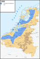 The Netherlands 1566
 The Netherlands begin 1572
 The Netherlands end 1572
 The Netherlands 1573
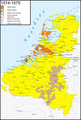 The Netherlands 1574-1575
 The Netherlands begin 1576
 The Netherlands 1576-1577
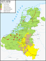 The Netherlands 1577-1578
 The Netherlands 1579
 The Netherlands 1580
 The Netherlands 1581
 The Netherlands 1582
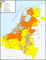 The Netherlands 1583
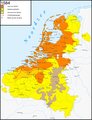 The Netherlands 1584
 The Netherlands 1585
 The Netherlands 1590-1592
 The Netherlands 1593-1595
 The Netherlands 1596-1598
 The Netherlands 1621-1628


.png)


