
Αρχείο:Karte Leipzig in Deutschland.png
Δεν διατίθεται υψηλότερη ανάλυση.
Karte_Leipzig_in_Deutschland.png (188 × 235 εικονοστοιχεία, μέγεθος αρχείου: 3 KB, τύπος MIME: image/png)
|
|
Αυτό το αρχείο και η περιγραφή του προέρχονται από το Wikimedia Commons. Οι πληροφορίες από την σελίδα περιγραφής του εκεί εμφανίζονται παρακάτω. |
Σύνοψη
| Περιγραφή |
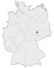
Deutsch: Karte mit der Lage der Stadt Leipzig in Deutschland.
English: Map of the city Leipzig in Germany. |
| Ημερομηνία | |
| Πηγή | See below. |
| Δημιουργός | See below. |
Αδειοδότηση
This image was generated with OpenGeoDB. The information there is placed in the public domain, images generated from OpenGeoDB are derivative works without passing the threshold of creativity, they are therefore also public domain.
| This work is ineligible for copyright and therefore in the public domain because it consists entirely of information that is common property and contains no original authorship. |
Ιστορικό αρχείου
Κλικάρετε σε μια ημερομηνία/ώρα για να δείτε το αρχείο όπως εμφανιζόταν εκείνη τη στιγμή.
| Ώρα/Ημερομ. | Μικρογραφία | Διαστάσεις | Χρήστης | Σχόλια | |
|---|---|---|---|---|---|
| τελευταία | 08:26, 26 Μαρτίου 2006 | | 188 × 235 (3 KB) | Jed |
Συνδέσεις αρχείου
Δεν υπάρχουν σελίδες που συνδέουν σε αυτό το αρχείο.
Καθολική χρήση αρχείου
Τα ακόλουθα άλλα wiki χρησιμοποιούν αυτό το αρχείο: