
Αρχείο:Dominican republic sm03.jpg

Δεν διατίθεται υψηλότερη ανάλυση.
Dominican_republic_sm03.jpg (331 × 356 εικονοστοιχεία, μέγεθος αρχείου: 18 KB, τύπος MIME: image/jpeg)
|
|
Αυτό το αρχείο και η περιγραφή του προέρχονται από το Wikimedia Commons. Οι πληροφορίες από την σελίδα περιγραφής του εκεί εμφανίζονται παρακάτω. |

|
This locator map image could be re-created using vector graphics as an SVG file. This has several advantages; see Commons:Media for cleanup for more information. If an SVG form of this image is available, please upload it and afterwards replace this template with
{{vector version available|new image name}}.
It is recommended to name the SVG file “Dominican republic sm03.svg”—then the template Vector version available (or Vva) does not need the new image name parameter. |


Transferred from en.wikipedia to Commons by Maksim.
The original description page was here. All following user names refer to en.wikipedia.
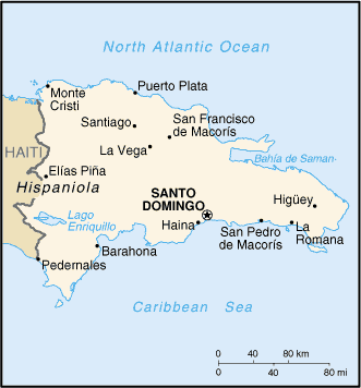
Map Of Dominican Republic from http://www.lib.utexas.edu/maps/cia03/dominican_republic_sm03.gif
According to [1] the map is released in:
This image is in the public domain because it contains materials that originally came from the United States Central Intelligence Agency's World Factbook.
|
 |
| date/time | username | edit summary |
|---|---|---|
| 13:04, 16 January 2006 | en:User:Darwinek | |
| 05:16, 12 January 2006 | en:User:Interiot | (rv random characters) |
| 03:35, 12 January 2006 | en:User:67.160.130.219 | |
| 19:06, 30 November 2005 | en:User:24.39.1.140 | |
| 01:47, 15 November 2005 | en:User:67.84.12.49 | (fukk u fo` real) |
| 02:54, 9 November 2004 | en:User:Balubino | (added copyright notice) |
| 22:08, 11 September 2003 | en:User:Pascal | (Map Of Dominican Republic from http://www.lib.utexas.edu/maps/cia03/dominican_republic_sm03.gif) |
Καταγραφές ανεβασμάτων πρωτότυπου αρχείου
Legend: (cur) = this is the current file, (del) = delete this old version, (rev) = revert to this old version.
Click on date to download the file or see the image uploaded on that date.
- (del) (cur) 22:08, 11 September 2003 . . en:User:Pascal Pascal ( en:User_talk:Pascal Talk) . . 331x356 (18131 bytes) (Map Of Dominican Republic from http://www.lib.utexas.edu/maps/cia03/dominican_republic_sm03.gif)
Ιστορικό αρχείου
Κλικάρετε σε μια ημερομηνία/ώρα για να δείτε το αρχείο όπως εμφανιζόταν εκείνη τη στιγμή.
| Ώρα/Ημερομ. | Μικρογραφία | Διαστάσεις | Χρήστης | Σχόλια | |
|---|---|---|---|---|---|
| τελευταία | 18:57, 29 Ιανουαρίου 2006 | | 331 × 356 (18 KB) | Maksim | La bildo estas kopiita de wikipedia:en. La originala priskribo estas: Map Of Dominican Republic from http://www.lib.utexas.edu/maps/cia03/dominican_republic_sm03.gif According to [http://www.lib.utexas.edu/maps/faq.html#3.html] the map is released in: { |
Συνδέσεις αρχείου
Δεν υπάρχουν σελίδες που συνδέουν σε αυτό το αρχείο.
Καθολική χρήση αρχείου
Τα ακόλουθα άλλα wiki χρησιμοποιούν αυτό το αρχείο:
- Χρήση σε en.wikipedia.org
- Χρήση σε eo.wikipedia.org
- Χρήση σε frr.wikipedia.org
- Χρήση σε fr.wikipedia.org
- Χρήση σε hr.wikipedia.org
- Χρήση σε id.wikipedia.org
- Χρήση σε incubator.wikimedia.org
- Χρήση σε is.wikipedia.org
- Χρήση σε it.wikipedia.org
- Χρήση σε ja.wikipedia.org
- Χρήση σε ka.wikipedia.org
- Χρήση σε kk.wikipedia.org
- Χρήση σε mg.wikipedia.org
- Χρήση σε oc.wikipedia.org
- Χρήση σε pcd.wikipedia.org
- Χρήση σε qu.wikipedia.org
- Χρήση σε ru.wikipedia.org
- Χρήση σε sh.wikipedia.org
- Χρήση σε sq.wikipedia.org
- Χρήση σε sw.wikipedia.org
- Χρήση σε uk.wikipedia.org
- Χρήση σε xmf.wikipedia.org